In Search of the Lardos Waterfalls
An adventurous walk into the hills above Lardos
There are waterfalls in the hills above the village of Lardos during rainy period. Although there is no documented route to find these this walk leads the way to such potential areas. There are some challenges in completing the route but nothing an experienced hiker should be incapable of. It has to be said that during times of rainfall navigating the full route may not be possible.

Walk Statistics
- Start location: Lardos
- Distance: km ( miles)
- Total Gain: metre ( ft)
- Total Descent: metre ( ft)
- Min Height: metre ( ft)
- Max Height: metre ( ft)
- Est. Walk Time:
- Walk type: Circular
- Walk Grade: Challenging
- Terrain: Country lane, dirt track, paths and rivr crossings
- Obstacles: This can be a challenging walk after winter rains have taken out paths.

Maps
The following maps and services can assist in navigating this route. There are links to printed maps and links to downloadable GPX route data for importing into navigational software and apps.
- GPX Route File
Accommodation
Pefkos Blue Studios, PefkosapartmentView in Google Map
- Website
- https://www.pefkosbluehotel.com/
- Description
- Pefkos Blue formerly known as Dimitri Studios, offering self catering apartment studios overlooking Pefkos village with splendid views across the bay. This is probably the best place in Pefkos if you want to be away from the village. Above the hubbub it offers unrivalled views and a quiet location.
Transport
Rhodes Public Transport - Bus Service
- Service Details
- Gennadi to Rhodes Town - KTEL Rhodes Public bus service serving the East Coast of Rhodes linking Gennadi, Kiotari, Lardos, Pefkos, Kalathos, Archangelos, Afandou, Faliraki and Rhodes Town
- Timetable
- https://www.ktelrodou.gr/
Walk Notes
This walk was prompted by a video on youtube of a waterfall that had a title of Lardos Rhodes Greece
. Despite a request to the author for a more definitive location, the response was no more than Lardos Village and ask the locals. Therefore an exploration was planned to head into the hills in the general direction of the main river. Of course venturing out in early October held little promise of encountering flowing water let alone cascading torrents tumbling down over rocky drops. Even so, it is worth seeking out a location in case the opportunity presents itself in the future to visit the island after rains have fallen.
This was a little difficult to plan. There are no definitive maps of Rhodes for navigating off road, or certainly none that I have thus far found. Those that do publicize themselves as hiking maps are not detailed enough to accurately assess a route. The use of the online app ViewRanger, which employs a variation of the OpenStreetMap mapping, does include a lot better details of contours, tracks and paths but these are by no means a definitive reference and looking at views on Google Earth there is a much larger network of paths that are not mapped. The difficulty with using Google Earth as a reference for plotting a route is that in some instances there is little to distinguish between a path and a dry watercourse, which would be a lot more difficult to navigate along. Despite this, a couple of routes were plotted to head into the hills above Lardos in search of waterfall locations. One was rather hopeful as to whether part of the route was navigable which headed high up into the hills, and a shorter, more confident route that is detailed here. The idea would be to follow the plotted route and if the going proved impassable to simply return along the direction that we came.
The end result was a success, although the walk provided some challenging obstacles which certainly provided a sense of achievement on completion of the walk. I would therefore advise that anyone thinking of following this route to be prepared for some clambering over rocks. There is nothing that cannot be accomplished by those who are experienced walkers and for those who are apprehensive or do not want to wander too far from a road then the first section to the first waterfall is easy. Having said this, the obstacles and challenges were due to the exceptional rains of the Winter of 2019 and no doubt as time passes the swept away tracks will be reinstated making this a lot easier to navigate around.
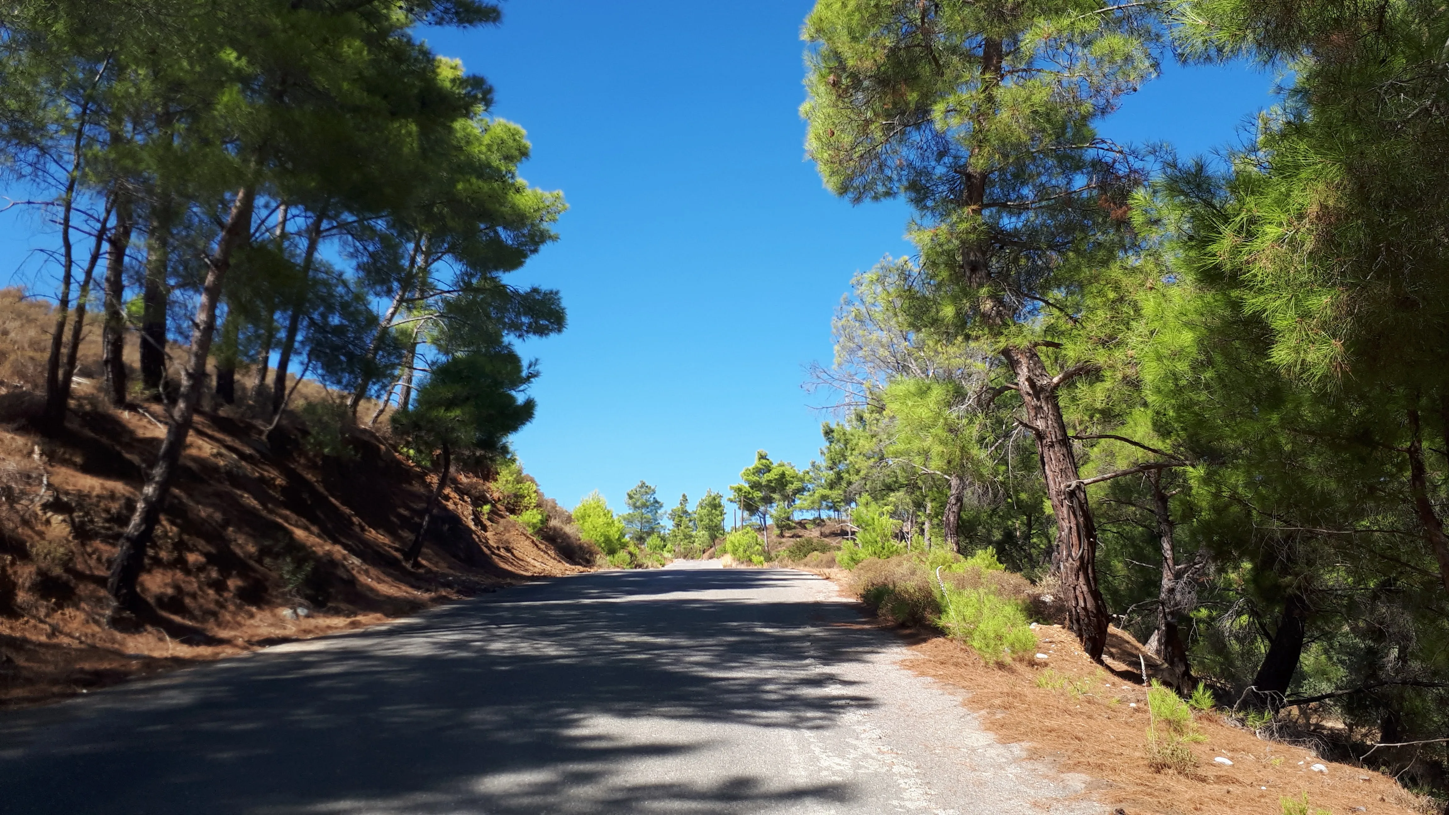
The start of the walk leads up towards the Ipseni monastery. This is a road route, heading south out of Lardos then taking the road on the right signposted for the monastery. This is an easy going country lane that is surfaced but has little traffic on it since it only leads up to the monastery, some 2.5km up in the hills. We only follow this part way and it is a pleasant easy stroll to start, gaining hardly any height over the first section. There is plenty to feast ones eyes on with flora, fauna and wildlife along the route. The climbing starts where the road makes a sharp left turn. There is plenty of shade from overhanging trees as the road climbs some 50m over a distance of 350m. This shade is certainly a relief on warmer days and a rest can be had at the next bend in the road where the Church of the Holy Cross sits on the junction with a dirt track.
A group of local lads stood by their two scooters outside the chapel. They had passed us on the way up here and judging by their antics were just out for the ride and a lark. We offered a friendly kalimera
and they responded likewise as we started the trudge up the next assent. Another 50m of climbing over a similar distance to the previous climb. The road then flattens out and in places the trees are a little sparser which provides some views that give a clear indication of the height gained.
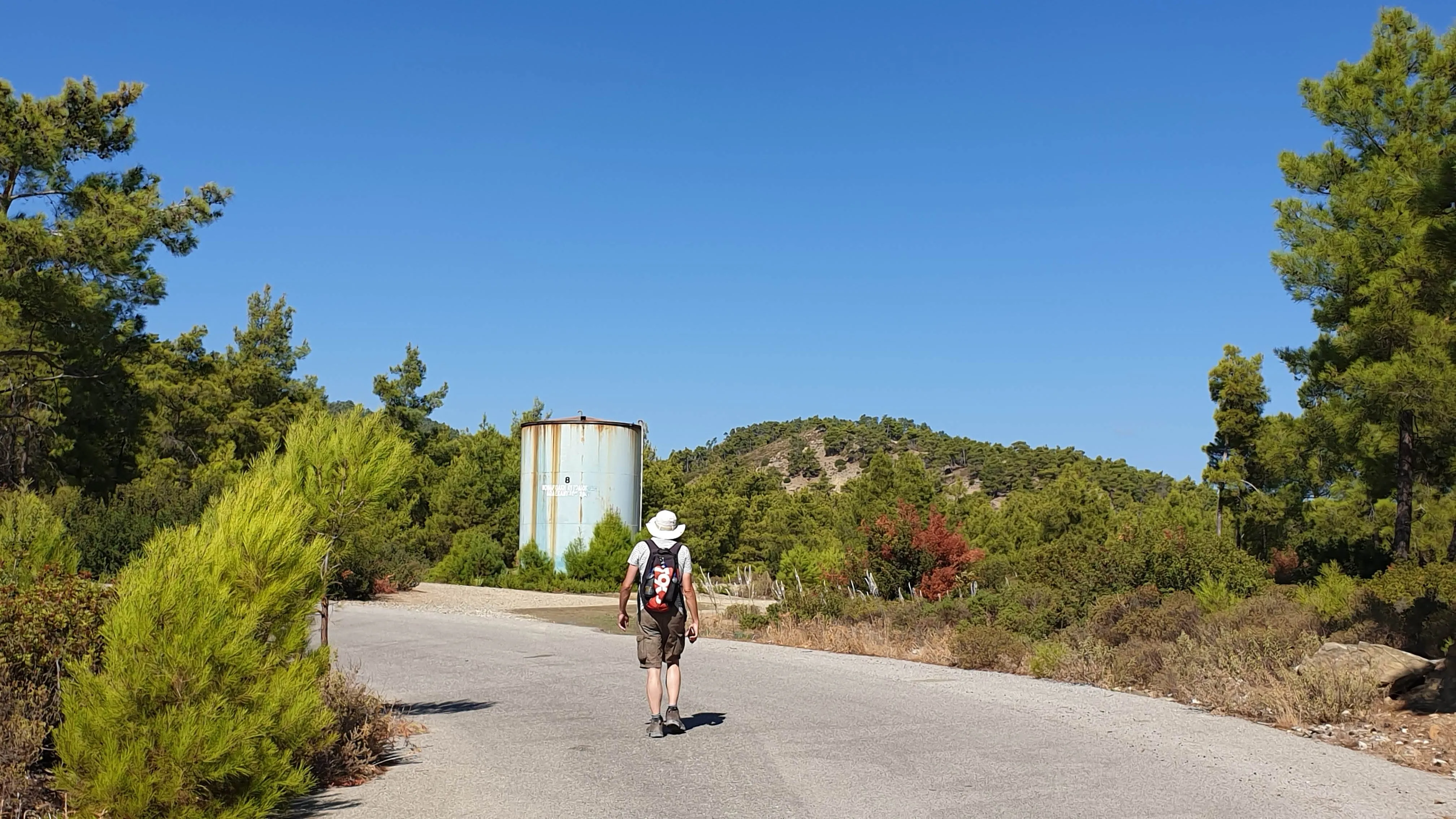
Before the road climbs further we take the track into the wilder side of the hills. This is marked by a large cylindrical green tank on the right hand side of the road, just before the road twists around to the left. A blue arrow has been roughly painted on the side of the tank and on the concrete base another blue arrow along with the number 79. I am not sure what significance the number is but the arrow must be to assist walkers as to the track to take. There is another track on the opposite side of the tank so it is easy to take the incorrect route if the arrows were not there, although having said that the incorrect track does not lead far.
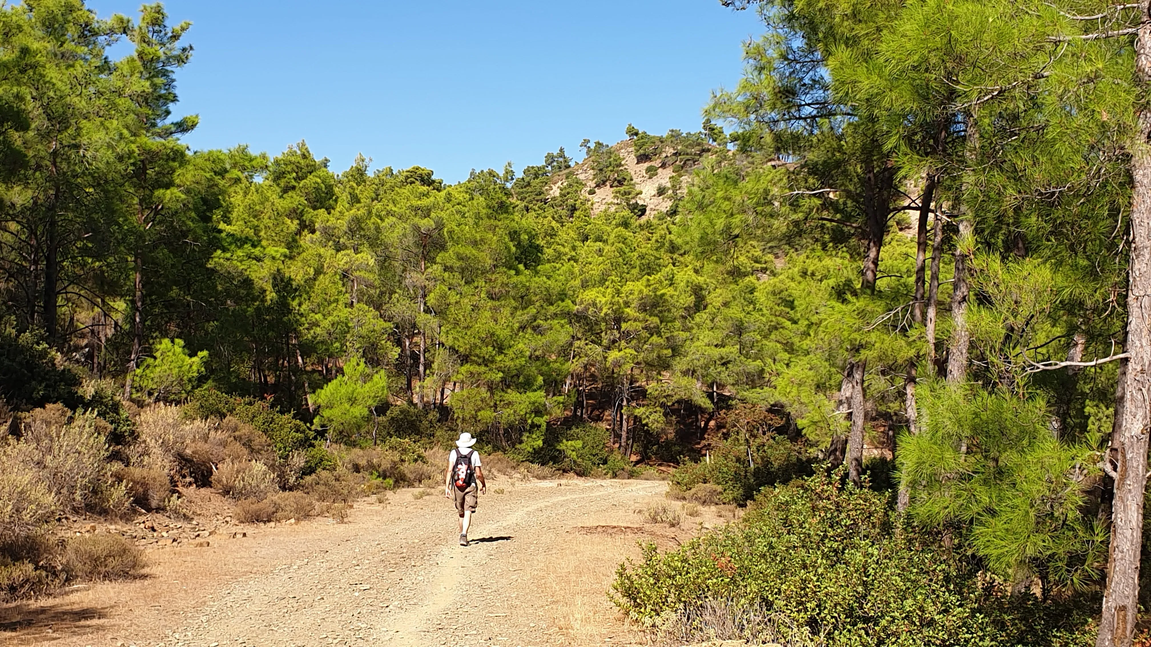
The track we now wander down is compacted stones and dirt which, on the whole, is fairly smooth and broad enough for an off road vehicle to get down. It gently winds its way down around the hillside, only descending a short distance. Although wide enough to take vehicles, with some evidence that such transport had navigated along the track, the dominant line marking the way onwards was an outlined path meandering across the track, picking the easiest way ahead when more stony areas appeared. This path must have been trampled by hundreds of boots throughout the year, compacting the dirt evolving into a clearly defined mark against the rest of the ground. Quite who uses this path, I cannot be sure. On all the expeditions that we have undertaken in Rhodes it is a very rare occasion to meet anyone other than a local farmer. Certainly not a hoard of hikers that appear to have trampled this track. Having stated this, I do know there are organised tours taking tourists out into the wilds, transporting them in tour coaches or pickup trucks for the more adventurous, and then leading them along such tracks as this. Maybe this was a regular tour route. Maybe this was a popular path to view a waterfall after the rains. There was certainly no-one about on this particular day, the whole scene was very peaceful and quiet.
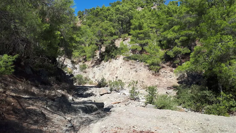
It is not long before we reach a twist in the track where it then doubles back around a crevice in the hillside, keeping at the same contour. This is obviously a place that water would quite spectacularly cascade down. An obvious waterfall from above, with plenty of rocks that would provide a spectacular scene of crashing torrents during times when heavy rains drench the hills. Where this crevice met the track the ground had taken a battering although not taking out the path completely allowing easy access across. From the opposite side are the obvious signs of where the water continues its descent downwards.
We stand and admire. Let the thoughts of winter rains fill the head and let the mind paint a picture of just how it would appear with a strong head of water thundering down, taking debris, rocks, branches and even tree trunks gorged out of the hillside, with it. It must be an admirable scene to witness for sure.
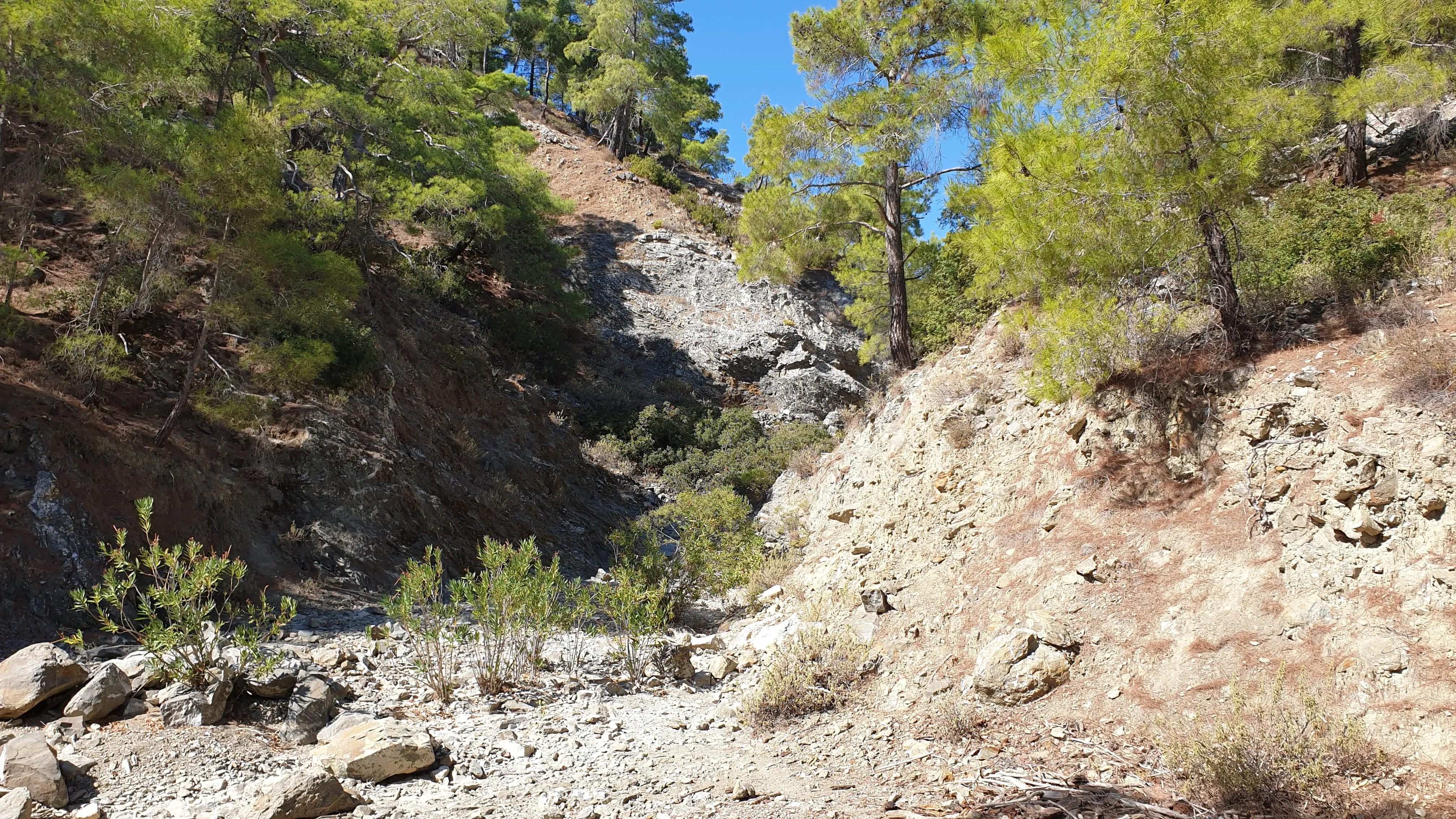
Could this have been the waterfall that had appeared on youtube videos, the long lost waterfall of Lardos? It is difficult to determine but there is a strong possibility. If this was the destination then we would have expected an end to the distinct path on the track. The sightseers came, saw and went. But no, as we continued onwards, the path was retained as distinct as before. This was obviously a well used walking route.
Shortly after this potential waterfall another small crevice was encountered where water had obviously flowed. Not as huge as the first but nonetheless a potential waterfall in rainy times. On this instance the track remained completely intact.
Eventually the path came to a Y-junction. The left led away with the ViewRanger map indicating the possibility of a circular route via the Ipseni monastery. That was something for another day as this planned circular route had Lardos as its start and end. The distinct trodden path that we had followed throughout the course of this walk appeared to favour the left fork. We took the right expecting to only have the track itself to follow. This did seem to be the case to start with, giving us the sense that we were taking a more adventurous route little used by others. But then it reappeared, not as distinct but nonetheless evidence of other hikers heading in this direction of the previous months.
The track then came to another crevice where the track twisted back on itself to continue along the contour. This also bore evidence of a lot of water having crashed down here and taking out the track completely. One could not walk directly onwards and in order to get past this obstruction we had to navigate into the crevice, then walk along a ledge on rocky earth to drop down onto the track 10m beyond. Nothing too tricky, just more of an inconvenience.
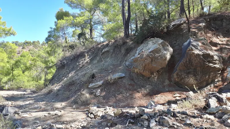
The section of the path has fewer trees which consequently entertained us with magnificent panoramic views. There were numerous fallen tree trunks laying flattened on the ground and by their contrast in colour it was obvious they had been there for a long time. Whether this was caused by a storm, an earthquake or merely some kind of forest management was difficult to determine. On the opposite side of the valley directly beneath us we could pick out what looked like the track we would be following. Beyond this, the coast could clearly be seen with tree clad hills as far as the eye could see. Views like this made the whole expedition well worth the effort.
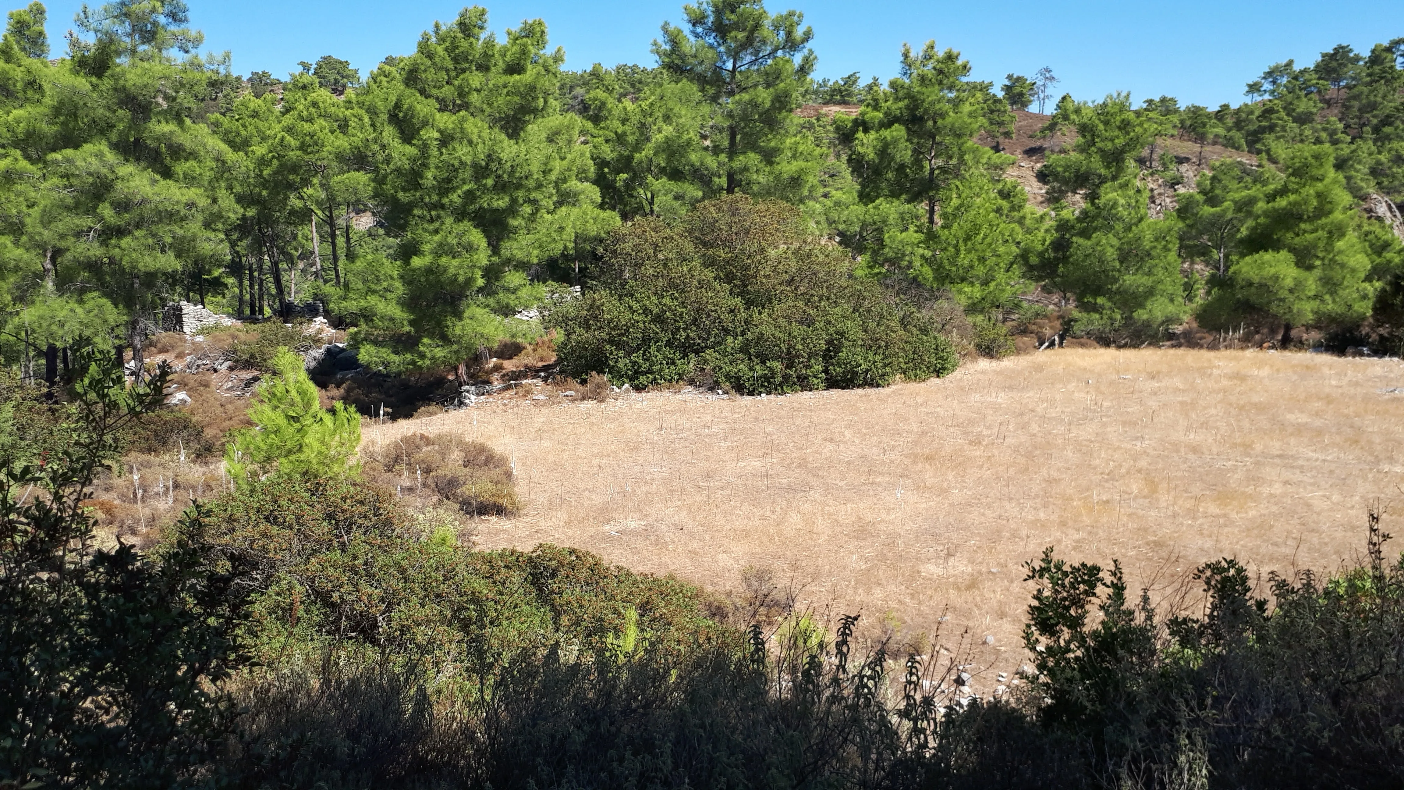
The track deteriorates here, still easy to pick out its course but much coarser with plenty of stony ground to pick our way over. It winds around steadily descending. Then there is a sharp turn and it reverses direction towards the valley where the Lardos river leads down. Shortly after this reversal of direction we come to an area of flat grass. One could easily describe it as a lawn. Probably some 50m square. It looks completely out of place. Like a bowls green. On a mountain side. How peculiar. It must be a quirk of nature for there appears to be no sort of civilisation associated with it.
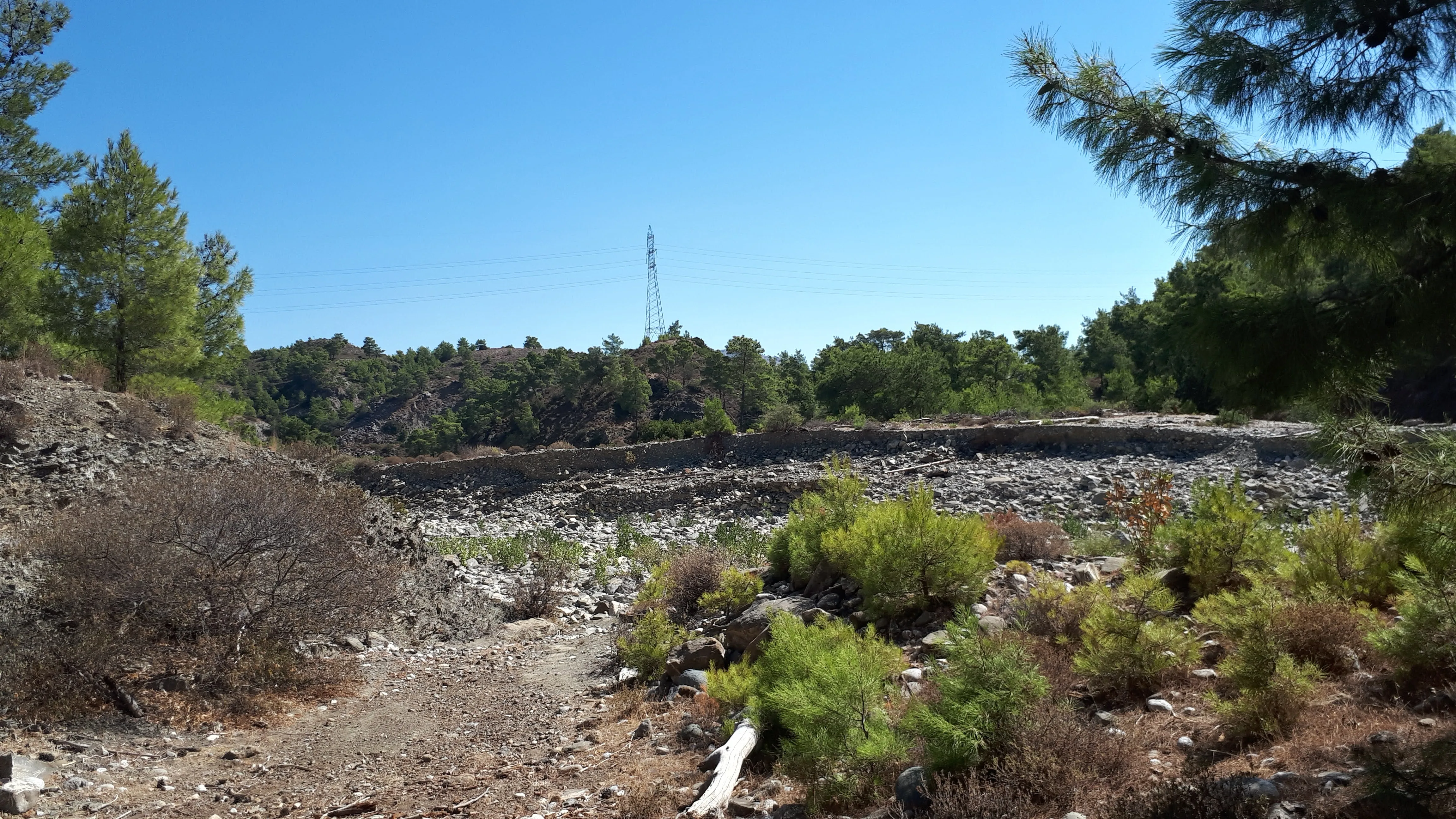
The track now rapidly descends down to cross a wide rocky channel of the river that flows down to Lardos. Immediately after another channel is crossed, the river course having briefly branched in its desperate attempt to get to the bottom of the hills. The track follows the far bank to the river up to the point where there is a sharp turn in the river course where it is halted by a large concrete dam. Of course this time of year nothing is halted. It is dry as a bone but the size of the dam, the evidence of the waters that have previously been here demonstrates the sheer weight, the colossal volume of water which the dam must hold back in times of storms.
The plot I had determined to get us past the dam followed the distinct path as depicted on Google earth which led to the bottom of the dam and then crossed the river bed to follow a track on the opposite bank. However that path was obliterated and large boulders littered the river bed with no clear indication as to the best route to take. It was possible to walk part way across the concrete top of the dam but then a steep cliff on the opposite bank barred the way. The course of the river led to another sharp turn below which was another dam with no clear way ahead or of how to get past that dam. We took another look at the river directly under the dam and visually studied the far bank which looked like it had been chiselled out into a small cliff by the flowing waters. But then what looked like a clambered path up the bank could be just made out. There was no other way so we made our way across, through the boulders and large stones marvelling at the power of water. How such a humble liquid could move mountains and deposit their remnants down stream. It was clear that this debris must have been carried over the top of the dam. The concrete footings were also eroded, forming cavities underneath and potentially undermining the dam itself.
At the far side a slope of scree and debris led to a cliff like face some 2-3m out of the river channel. It was evident that others had walked this root and with a scramble and clamber up the more substantial rocks enabled us to get to the track above. This was a relief. On the opposite side the thoughts had gone through my head that we may have to return along the route we came having virtually completing the route. Now having got across the river there was little more height to descend as we were in the broad valley that Lardos sat within.
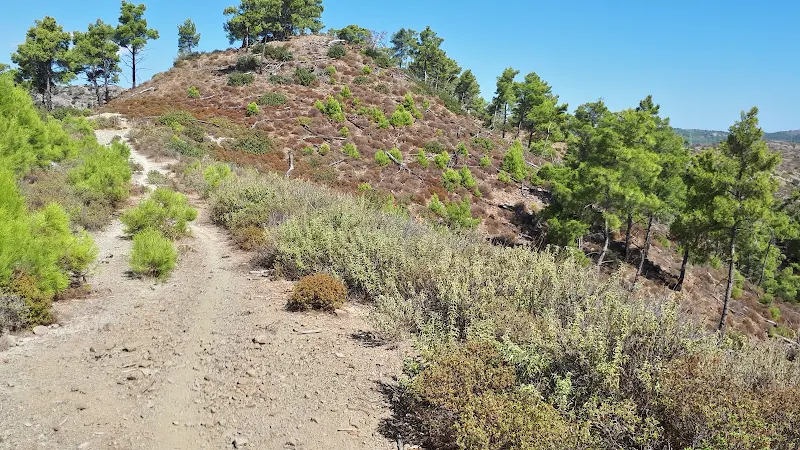
The path cuts across the land where a broad turn in the river course to meet up with it again some 0.5km down stream. The path then heads briefly back up stream to pick up a track across the river. This certainly looked well used by vehicles with areas where construction debris had been deposited. A sort of waste tip on the scrub by the river. This sign of civilisation was enough to make us think we had completed the course. The obstacles and challenges overcome. But what a great walk.
The final section is an amble down the track following the fairly straight coarse of the river through the broad valley. A simple meander that leads into Lardos where a reward of a long cold beer was waiting. We had seen no waterfalls but had certainly confirmed places where such wonders could be found in wetter times. It has to be said the whole walk was awesome and well worth the effort.
Directions
An adventurous walk up into the hills above Lardos
Leave Lardos from the square, taking the road that runs directly through the square heading south east, with the water fountain on ones right and Memories bar on ones left. Head out of Lardos, across the river bridge until a road junctions on the right with a signpost for Monastery Ipseni some 0.5km from Lardos square. Take this and continue for some 1.7km. This is easy walking to start then the road turns a sharp left and starts to ascend. After 350m there is a sharp right past the church of the Holy Cross and another ascent. 350 beyond the church there is a large green cylindrical tank to the right of the road, just before the road bends around to the left. An arrow on the tank points down a track to the right. Take this track.
After 0.5km the track reaches a crevice in the hillside where the first waterfall would be found in wet weather. After a further 1km there is a Y-junction. Take the right hand track. Keep to this track. It will eventually double back on itself to quickly descend down to the Lardos river. Kept to the clearly defined track which crosses the first part of the river then shortly after a separate branch so that one is walking on the far bank to the river. The river turns a sharp left to be met by a concrete dam. Keep to the track which leads past the dam and down to the river bed beyond. Cross the river bed aiming for the far bank close to the bottom of the dam where there is access up onto a track on the opposite side. This can be a bit of a clamber. Follow the track through the trees until it meets back with the river some 0.5km beyond. Once again follow the well worn track which will turn a sharp left to follow the river upstream, then it doubles back to provide a track diagonally across the river bed to the far side where a broad dirt track follows the river all the way back into Lardos.
At Lardos one can simple keep to the riverside track and emerge onto the road into the village or take the opportunity to negotiate a route through the narrow streets and alleys of the village. It is only a small village and you will not get lost.
Refreshments
Memories, Lardos View in Google Map

- Address
- The Square, Lardos
The Facebook page for this village centre bar states Wonderful bar that serves breakfast and lunch, open all day and night serving amazing cocktails situated in the square of Lardos, come join us with any music of your choice!
This really encapsulates this lively and friendly bar. Always a cheerful welcome and what better place to sit, have a drink and relax watching the world enfold before you, not matter what time of the day or evening.
A long beer and a Greek omelette was our reward for completing this challenge. One of our favourite tavernas. Always feel welcome here like it is a second home!
Image Gallery

Route Validation Cards
Validation Date - 2020-10-11
- Time of Walk: 10:30 to 14:00
- Validators: Griffmonster, Kat
- Weather Conditions: Very warm day, clear skies
- Notes: Initial route undertaken
Summary of Document Changes
Last Updated: 2026-03-30
- 2020-11-15 : Original publication
- 2021-03-17 : Update website improvements and removal of ViewRanger reliance
- 2021-12-01 : Removal of ViewRanger links due to its imminent demise
- 2026-01-12 : Major website update with all walks recast to the new format


0 comments:
Post a Comment