Haraki and Feraklos Castle
A climb from Haraki beach to Feraklos Castle
Feraklos castle stands guard above the village of Haraki. The castle is in ruins but is extensive in size. It is a rough scramble to get into the castle walls but worth the effort in order to admire this site which is the size of a small village. There is an information board in Heraki that details the history and archaeology of the area.

Walk Statistics
- Start location: Haraki Bus Stop
- Distance: km ( miles)
- Total Gain: metre ( ft)
- Total Descent: metre ( ft)
- Min Height: metre ( ft)
- Max Height: metre ( ft)
- Est. Walk Time:
- Walk type: Circular
- Walk Grade: Easy to navigate
- Terrain: Dirt tracks, rough paths
- Obstacles: The entrance into the castle is a scramble. There are no safety measures applied to the castle and it is full of hazards. Extreme caution should be applied. Stout shoes or boots should be used for this walk.

Maps
The following maps and services can assist in navigating this route. There are links to printed maps and links to downloadable GPX route data for importing into navigational software and apps.
- GPX Route File
Accommodation
Pefkos Blue Studios, PefkosapartmentView in Google Map
- Website
- https://www.pefkosbluehotel.com/
- Description
- Pefkos Blue formerly known as Dimitri Studios, offering self catering apartment studios overlooking Pefkos village with splendid views across the bay. This is probably the best place in Pefkos if you want to be away from the village. Above the hubbub it offers unrivalled views and a quiet location.
Transport
Rhodes Public Transport - Bus Service
- Service Details
- Gennadi to Rhodes Town - KTEL Rhodes Public bus service serving the East Coast of Rhodes linking Gennadi, Kiotari, Lardos, Pefkos, Kalathos, Archangelos, Afandou, Faliraki and Rhodes Town
- Timetable
- https://www.ktelrodou.gr/
Walk Notes
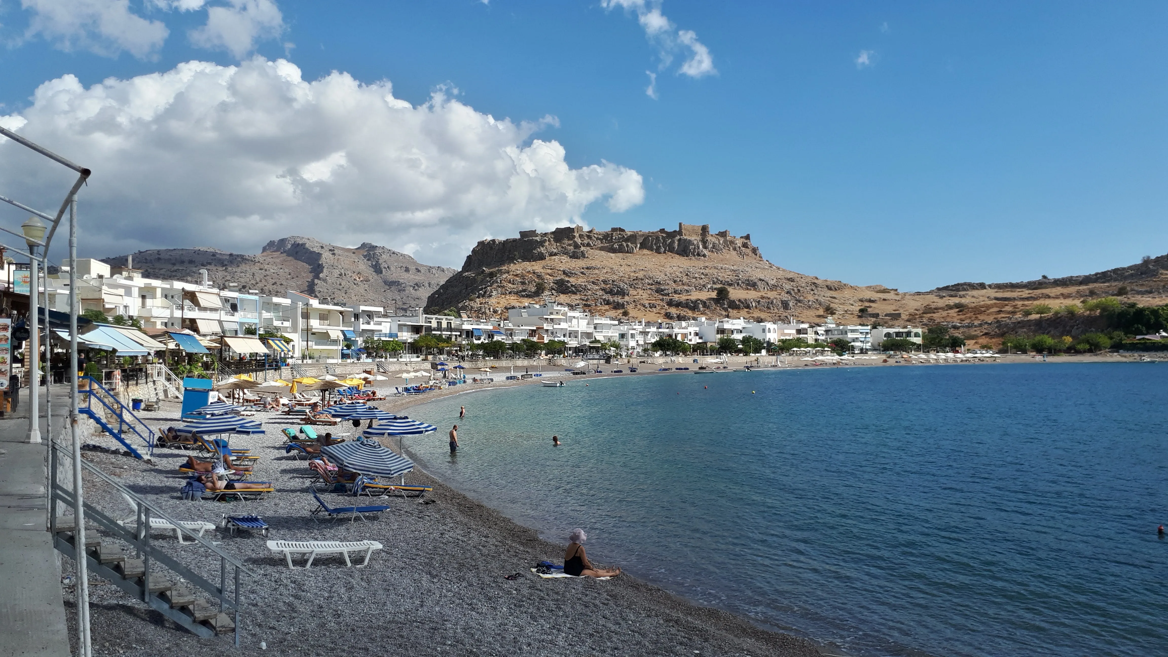
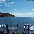
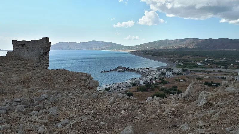
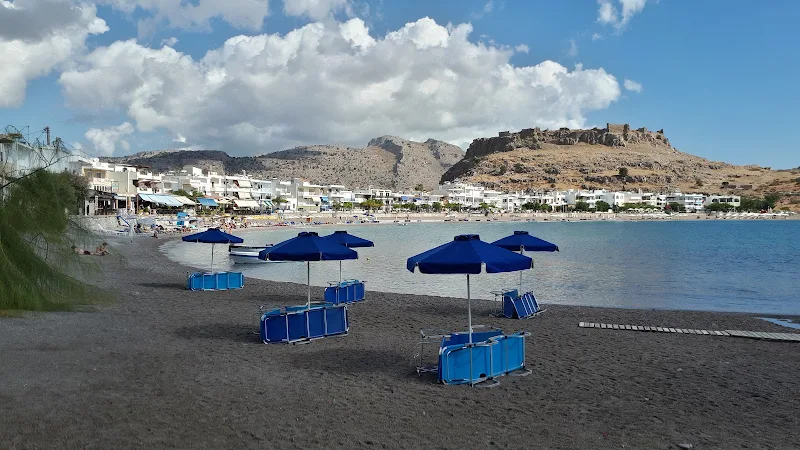
Haraki village is located on the Rhodes east coast some 12km north of Lindos. This traditional fishing village has less than 200 residents is set around a small picturesque cove. The tourist is well catered for with plenty of bars, tavernas and restaurants that look out across the bay. The beach is shingle and is a haven for those who seek a quieter location away from the hoards.
There is a limited bus service from both Lindos and Rhodes directions and the bus stop is located on the southern side of the village opposite Tommys Taverna. A more extensive bus schedule can be accessed at Massari Crossroads on the main road which is only 2km from the village. The road to the crossroads is not busy although in 2020 it was upgraded when the river bridge on the main road collapsed. To return to the crossroads from Haraki take the road out of the village to the south, crossing over the river bed and keep following this to the main road.

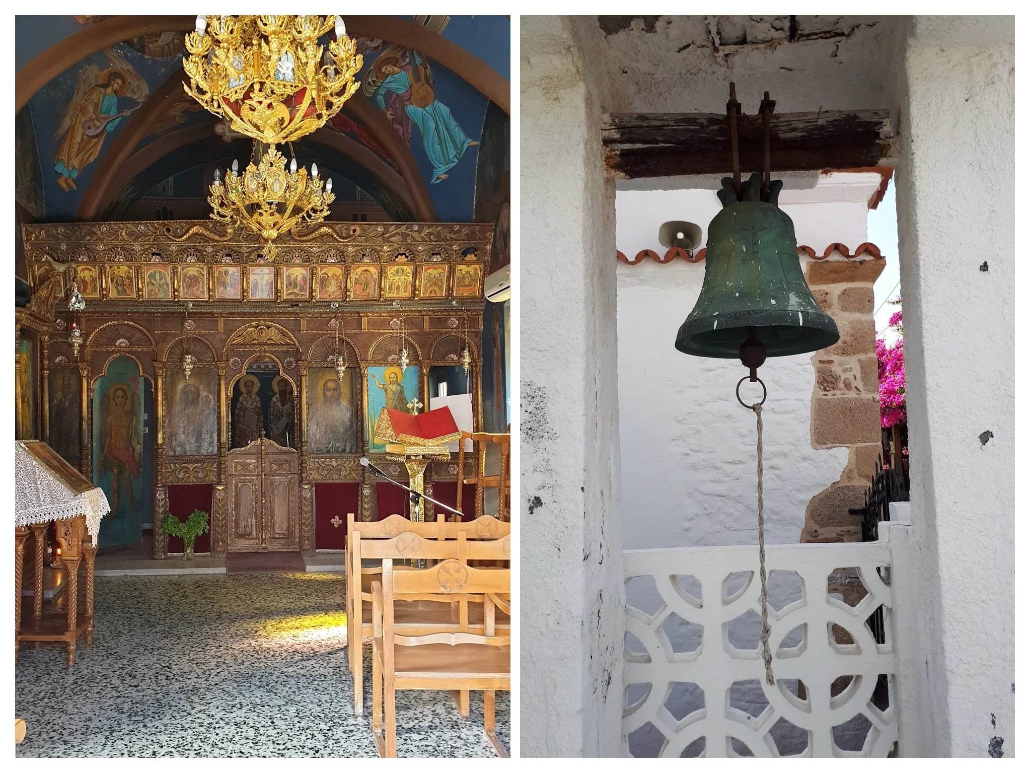
When entering the village follow the path around to the start of the sea front by Argo Restaurant in order to take in the full extent of the bay, this will delight the eye of any visitor. Then as we proceed along the seafront it is well worth taking a brief excursion through the first alleyway to check out the small chapel known as the Church of the Holy Apostles (Άγιοι Απόστολοι). This is a traditional Greek chapel that sits just behind the seafront and probably often overlooked by many visitors. The humble building sits under an arched clay tiled roof and there is a simple square bell arch set within its perimeter wall. The interior is full of old iconography with framed depictions of biblical scenes and the walls and ceilings covered with frescos. The worn and ageing woodwork of the iconostasis definitely gives the appearance that this must be an old building. Exactly how old this is, I have yet to determine but it would not surprise me if the age was measured in centuries. Golden chandeliers hang from the ceiling and there is a speckled tiled floor which looks somewhat out of place.
A sign on the exterior of the building has the following inscription, indicating that it has more recently been repaired:
Η ΕΣΩΤΕΡΙΚΗ ΕΠΙΣΚΕΥΗ ΤΟΥ ΙΕΡΟΥ ΝΑΟΥ ΕΓΕΝΕΤΟ ΔΑΠΑΝΗ ΤΩΝ ΕΝ ΑΜΕΡΙΚΗ ΚΑΙ ΚΑΝΑΔΑ ΜΑΛΩΝΙΤΩΝ ΜΕ ΕΔΡΑΝ ΤΗΝ ΒΑΛΤΙΜΟΡΗΝ ΤΩΝ Η.Π.Α.
THE INTERNAL REPAIR OF THE HOLY TEMPLE WAS EXPENDED BY THE MALONITES IN AMERICA AND CANADA WITH THEIR HEADQUARTERS IN BALTIMORE.P.P.
Close to the Chapel is an information board which states that a cracked marble slab was discovered here by the French archaeologist Victor Guerin which bore a list of priests of the God Poseidonas Ippios and concluded that a small temple dedicated to the God must have stood here in ancient times. This information board is a mine of information for those seeking the history of the area. I tried to capture this in a photo but the glass screen made the result unclear and so I cannot replicate the words here. I advise any curious visitor to search this out.
Continuing along the seafront one finds numerous tavernas and restaurants offering everything from just a drink to full meals. In the distance sits Feraklos castle standing guard over the village. This is the aim of the walk.
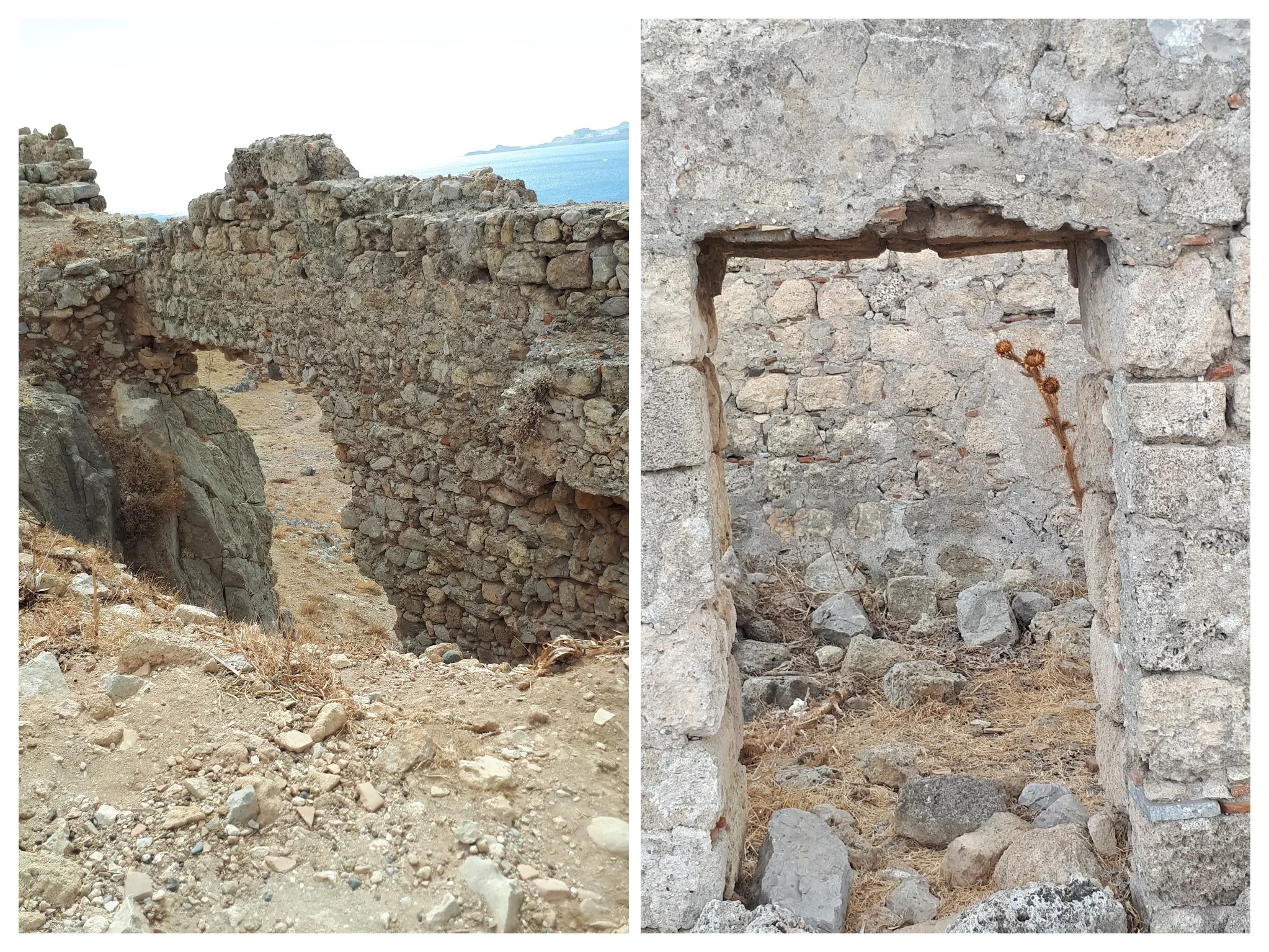
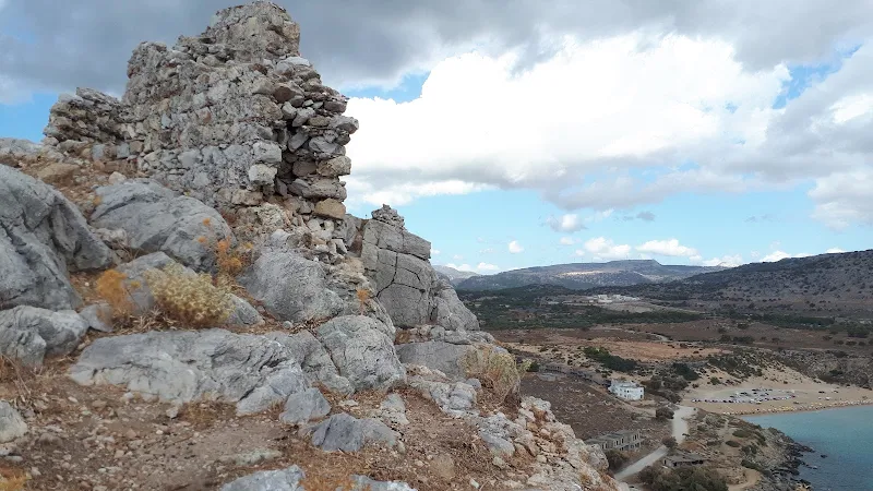
Continue along the length of the sea front to where a track leads back upon itself as it starts to climb above the bay providing a glorious panorama. A little further along there is a track that leads off to the right, this leads up to the foot of the castle and as one climbs the extent of the ruin begins to come into focus. At the end of the track, a path leads off to the left, picking its way around the base. There are no way markers, no information boards, no directions as to the way in. This is left up to the visitor. There is a path beaten out by hundreds of shoes and boots that leads up into the ruin. It is a scramble and good footwear is necessary but the climb is nothing arduous and anyone of average fitness should be able to undertake this. This route is assumed to have been the main gate and entrance to the castle, a formidable entry to any invader let alone curious visitor
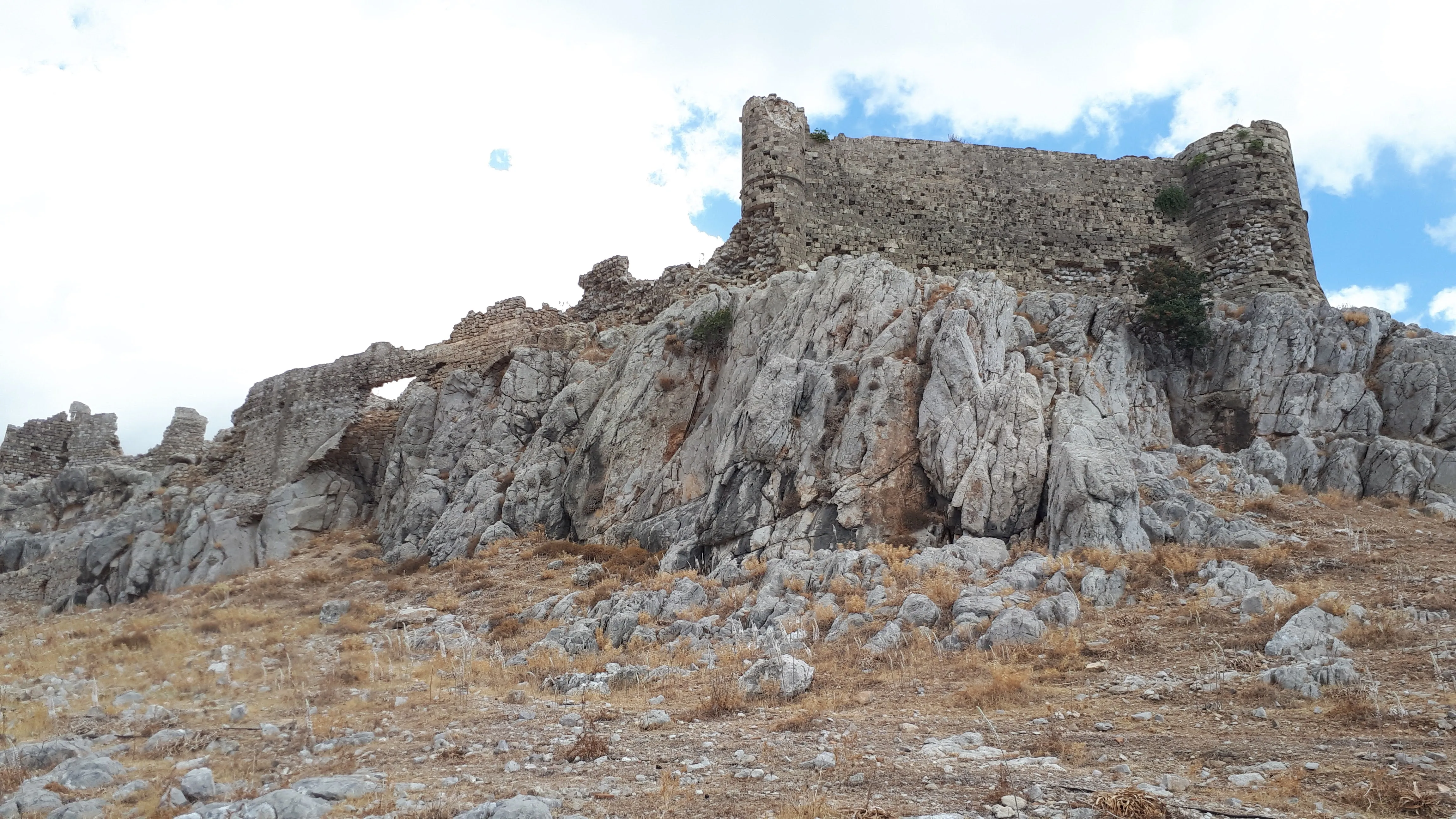
It should be noted here that the castle is a very raw ruin. There are no safety barrier to the sheer drops, there are no signs to warn of the dangers of the rough ground and the crumbling walls. Use ones common sense. Tread carefully and do not take unnecessary risks.
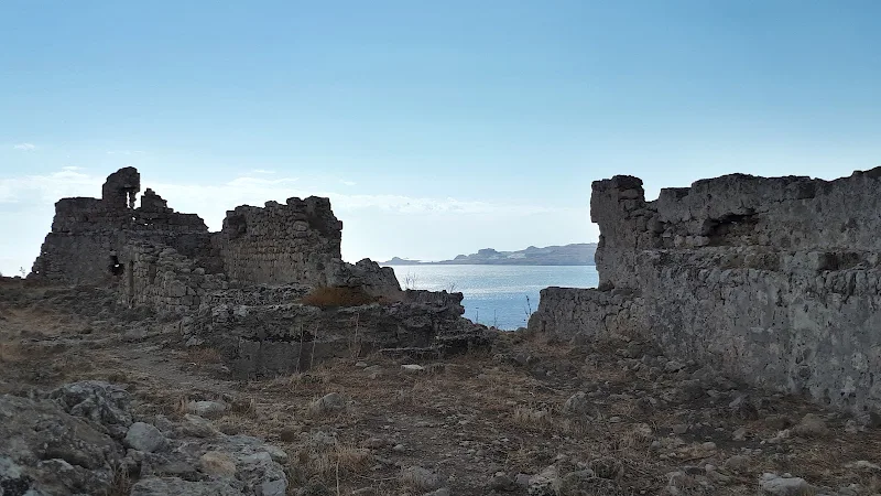
As one emerges up into the castle compound the true extent of this structure is revealed. It looks pretty sizeable from the exterior but from the interior one instantly sees that this was more than a simple fort, but a whole fortified village that could sustain many people. There are remnants of numerous buildings and structures across the area encompassed by the walls. Back in its day, from the early 14th century, when the Knights of St John occupied the castle, it became the sanctuary for many local villages in the event of attack by sea bourne invaders. A routine was in place for such occasions and the folk of Rhodes all had an allocated castle to head for.
The history of the castle predates the Knights of St John though, for they merely used a former structure to create the castle. There is speculation that this was once an ancient Acropolis that probably would have rivalled that of Lindos. Do read the main article to this walk which provides more information and references about the history of the castle for those interested.
In the centre of the complex there is an underground room whose arched roof has collapsed. This is probably the cistern, a place they stored water which would have been scarce during summer months. Some of the perimeter walls remain intact, giant stones that appear to have pottery fragments shoring them up. These curved pieces of fired clay are a mystery and one wonders exactly when these must have been put in, whether this was an exercise to retain the stability of the wall in later years. In places one can see the thickness of the walls which are clearly very substantial. and one can even pick out the remains of round towers.
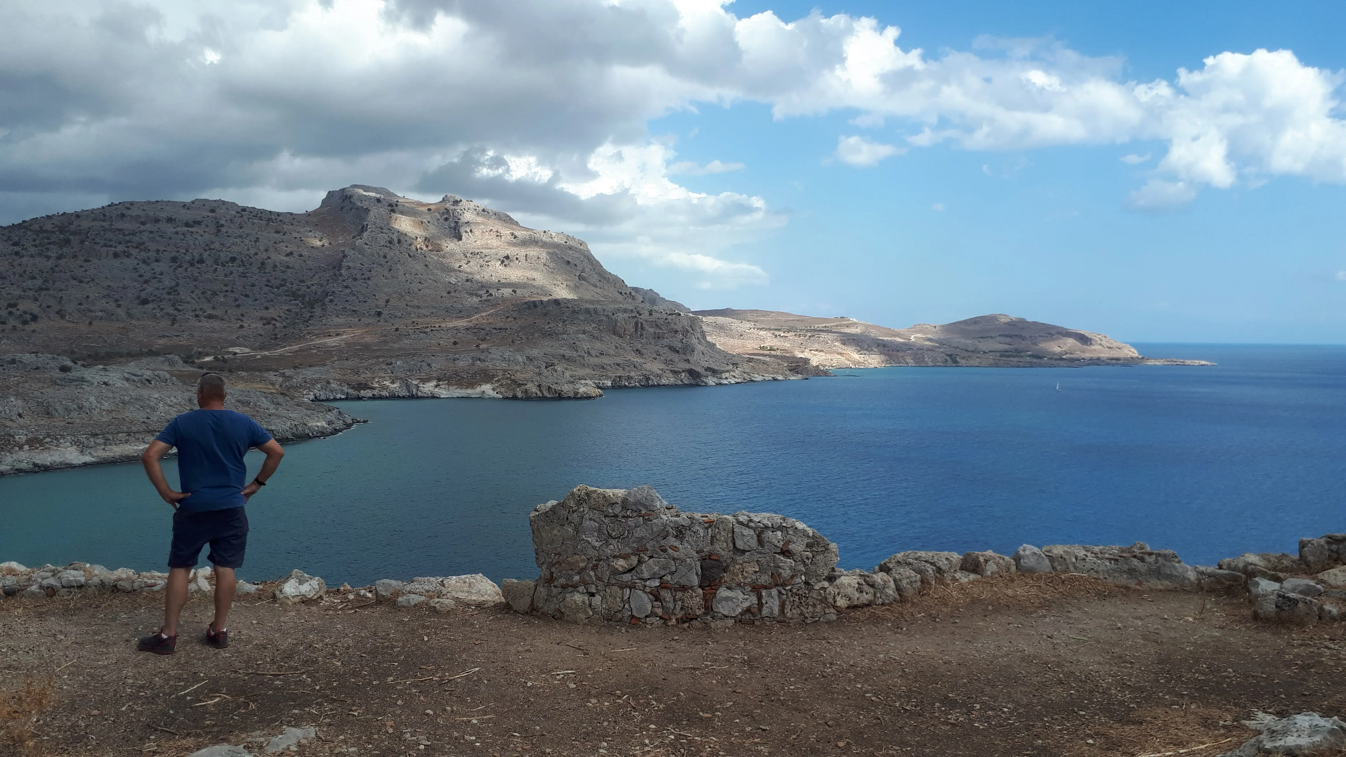
In addition to this amazing relic from antiquity the views from up here are stunning. One can see that any invader would be spotted whether from land or sea.
The return is back down from the fortress on the scramble that one came up. We then continue along the foot of the castle to descend the remnants of the stone steps that take us ddown to the road behind the castle. These are in a poor state and caution should be taken in proceding down these. There has been a renovation fund set up for the castle and the steps are in line for the first part of the renovation which will improve access tot he structure without a doubt.
One can easily appreciate that in its day this must have been a formidable structure to take on by an invading army. With its 360° views and dominating vantage point it would have served as a key focal point in the Rhodes medieval defences.
At the base of the castle, close to the road, any observant passer by will notice two cave entrances. These form a tunnel that links them. This is not easy to determine as they are pitch black inside and one needs to turn a corner at the end to see any light from the opposite entrance. A torch is highly recommended to navigate these. Their purpose is unclear with various suggestions as to their use including the stabling of horses for the castle or part of a more extensive tunnel complex that led through to the sea side of the castle. However, certainly the ground to these tunnels appears to be very much even and one can think they have been machined, so they may be more modern. This gives a wider speculation including that they may have been a remnant from WWII. Until more clarification can be found they remain a complete mystery.
The return journey is across the scrub from where the road curves by the castle. This is easily picked out and leads through to the road behind the seafront buildings. All in all why not a make a day of this, explore Haraki, visit the castle and take in the views with a little beach time.
Directions
Short walk to Feraklos Castle
Follow Haraki sea front around the bay to the far end where a track doubles back and upwards. After a short distance another rough track leads off to the right heading for the castle. Take this and where it ends the is a simple path through the scrub around the base of the castle. The entrance to the structure is a scramble up through the opening in the walls which is thought to be the original entrance, although now much crumbled. The castle is extensive and one can wander around the whole structure. Care should be take as there are many obstacles and uneven surfaces and sheer drops.
Return from the castle through the way one entered then continue along the base of the castle to the stone steps down to the road. These are worn and crumbling and care should be taken negotiating the way down. The first entrance to the tunnels is on the right towards the bottom of the steps. This leads around to the road, or continue down the steps to the road. A footpath leads from the road across the scrub and into the back of the village.
Refreshments
Bottoms Up, Haraki View in Google Map
- Address
- Bottoms Up, Haraki
- Website
- https://www.facebook.com/people/Bottoms-up-kitchen-cafe-haraki/100054478270387/
Beach side cafe on Haraki sea front
A long cold beer to end a perfect day
Features
Feraklos CastleView in Google Map
Like much history and pre-history for the island of Rhodes, Feraklos presents many challenges to determine the true background to its existence. Many tourist websites and documentation make a passing reference to the castle in relation to its neighbouring village of Haraki some offering a very brief synopsis of its past with no citation or reference as to where the information is taken from. Some descriptions of the Castle make reference to archaeological studies conducted over the years but as there are no specific citations to such studies it is difficult to conclude whether this is just speculation or reality. The information board behind the chapel at Haraki does provide much historic information and includes references to French archaeologist Guerin who investigated the area during the early years of the 20th century. Such investigations for documented evidence are made more difficult for an English speaking researcher as a lot of information may have been documented in Greek, or in Guerin's case, French. What is presented here is a rough guide to what has been discovered from various items of documentation. If new information comes to light then this page will be updated, with references added accordingly.
The first hurdle to overcome when researching the castle history is its name. Modern Latinized documentation refers to it as Feraklos Castle. It was soon discovered that the spelling of the name from older documentation translates the name as Pheraclos (Φεράκλου). This is down to the Greek letter phi (Φ) which is an f sound but can also be used as a ph as in philosophy and was commonly used as such in ancient translations. Other names that have also been used are Feraklou (Φερακλού) and Faraklenon (Φαρακλενόν).
The adjacent village of Haraki appears to be a modern creation and historically the area is part of Malona therefore little can be found other than tourist information when searching the name of the village. However it would be difficult to assume that the sheltered bay on which Haraki stands was not used in historic times as a shelter for ships and there may have been some kind of community or landing stage associated with the castle Haraki. The information board at Haraki references the ancient village of Salia as being in the same location as the modern day village, it name having the meaning of next to the sea
. There are certainly references that the area was used for passing ships that voyaged between Rhodes and Alexandria. There are also references to many ancient villages and communities which have now long disappeared.
What appears to be well established and is described in great detail in an assortment of historical books and documents concerning the Crusades and the History of the island is that the construction of the castle occurred during the early 14th century by the invading Knights of St John, otherwise known as the Order of Knights of the Hospital of Saint John of Jerusalem or Knights Hospitaller for short. After the fall of Jerusalem in 1187 by the forces Saladin, the Knights sought refuge, first arriving on Cyprus before mounting an attack on Rhodes in order to create a permanent base.
The assault on Rhodes began on 20th September 1306 when, aided by an army of mercenaries from the Greek island of Castellorizo, they launched an attack on the fortress of Feraklos which lasted for three days. The very fact that this first attack was at such a strategic point indicates that the fortress predated the Knights arrival. It took a further two years to complete the invasion of Rhodes and to establish a base that lasted for over 200 years. As part of the defences to secure the island the knights constructed a series of castles including Feraklos. The strength and location of these served them well for they suppressed numerous and substantial attacks by pirates and Islamic invaders during their residency on the island. It took what some have described as a 200,000 strong army of the Sultan Suleiman the Magnificent to defeat them. Although some depute this figure, even a speculated lower figure of 100,000 aboard some 400 ships was something that even the Knights with such strongholds could not withhold against.
Without a doubt the Knights played a large part in the development of the fortifications all across the island, including Feraklos. It seems certain that some sort of fortification had stood here prior to the Knights invasion and some have claimed that this was in ruin when they arrived. It was highly likely that this was a Byzantine fortification which the Knights used as the basis for bigger and better defences. There are other examples of Byzantine constructions on Rhodes including the walls of Rhodes town which were certainly in place in the 3rd century BC as the Greek engineer, physicist and writer, Philo, references them in his the treatise Parasceuastica (παρασκευαστικά)
(Preparation for Sieges). There is nothing to substantiate that Feraklos would have existed this far back, but then there is no reason to dismiss this idea. Until a fully detailed survey of the present ruins at Feraklos is conducted we can only speculate on both the age of the original construction and the scale of work undertaken by the Knights of St John to strengthen any pre-existing structure.
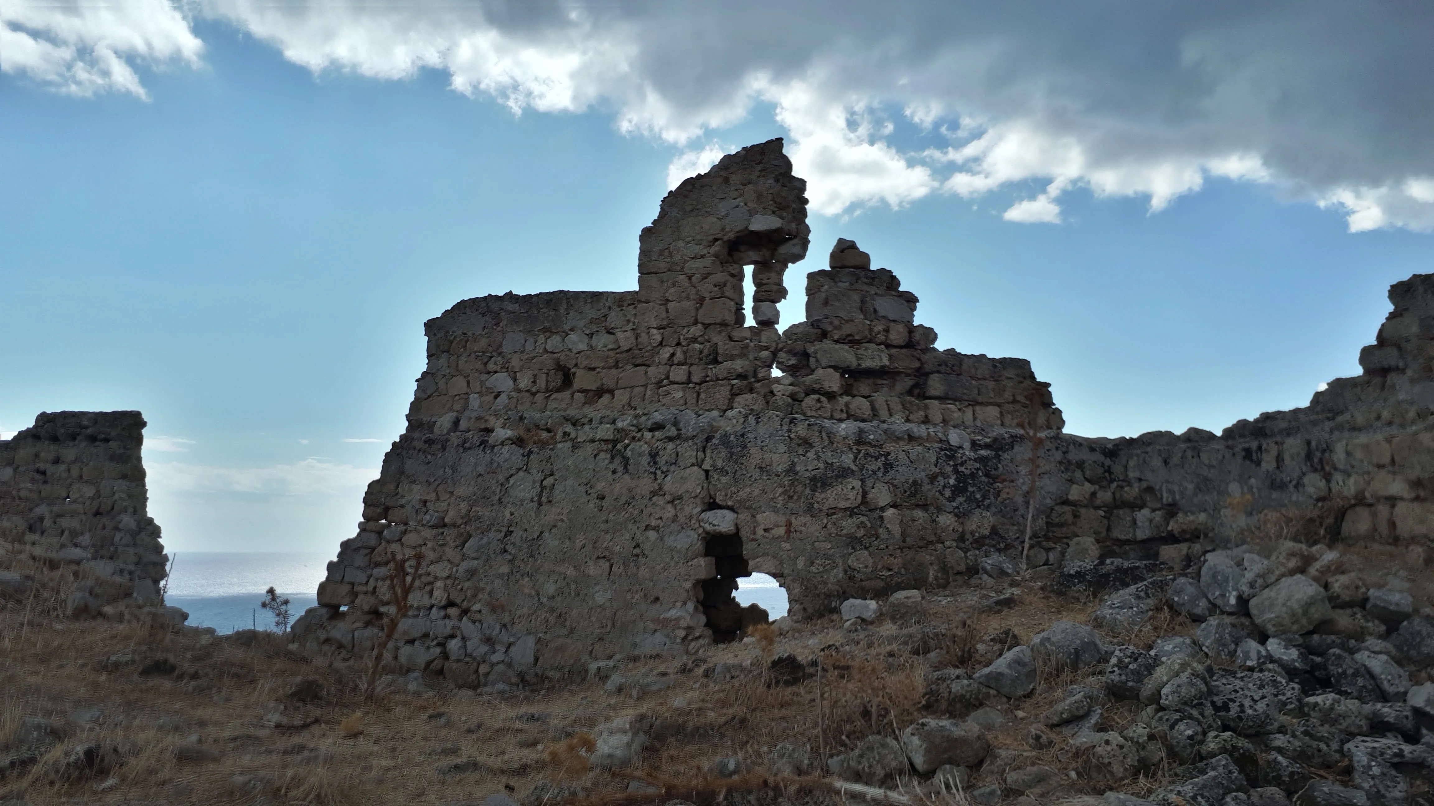
Without a doubt the fortress held by the Knights was a formidable structure. The sheer scale of the construction can only be appreciated by visiting the ruins which have an area of some 1700m² bounded by 680m of defensive walls that are over 2 meters thick. This all stands on a 85m tall rocky hill with sheer drops on all sides making an impressive defensive area. Two rectangular ramparts formed the main gate which is thought to be where the present day path leads up into the castle. Two cylindrical towers, one on the north and one to the south east provide looks outs for all approaches and these can still be picked out in the ruins. It is also reported that the coats of arms of the Order of the Knights of St. John as well as the Grand Master Giovanni Battista degli Orsini are preserved on the walls although these were not observed during the visit described in this travelogue and it probably would take someone with a trained eye and some idea of their location to find them. It was noticeable that many of the ruined walls include what looked like broken fired pottery filling the cracks between the stones that made up the wall. These fragments displayed a curvature and a colour that one associates with ancient pottery but not being a trained archaeologist this is only speculation. Even so it provokes many questions on why such fragments had been employed in the construction or whether they were a later adornment as an attempt to preserve the wall.
The compound that this massive complex encapsulated was said to have included the remains of two ancient Greek temples, a Byzantine church, the Knights' quarters, a cistern and many other rooms and vaults. Today, the cistern tank is easily picked out which is the sunken arched room in the centre of the complex. Much of the rest of the ruins are pretty much indistinguishable to the untrained eye although the towers are still somewhat intact with window arches still in place.

During times of impending attack the Knights had set up a system of alerting the local population. Each village and community had a specific castle to which they had to muster when an attack was imminent. For Feraklos this included the now lost villages of Salix (most likely where Haraki is located), Katagros (the forerunner to the modern village of Masari) Janadoto, and Camimari (Cameri) as well as Malona. Also included were citizens from further afield places such as Kalathos, Pilona, Lardos, Asclepios, and Yanadi.
Below the fortification was a fertile table land. Cecil Torr in his 1887 publication Rhodes in Modern Times
makes reference a 15th century German explorer Arnold von Harff who claimed that Ships leaving the city of Rhodes for Alexandria came in to the bay between Pheraclos and Lindos for wood and fresh water
. This could well have been the bay at modern day Haraki with water supplied by the Gadoura river.
Torr also makes reference to a hoard of Greek coins that had been found in the area and speculates that an Acropolis predated the Byzantine structure and the area where the coins were discovered was the ancient city of Astyra to which the Acropolis belonged. Torr is not the only one to speculate that an Acropolis once existed here with some references stating that it included a temple dedicated to the Greek God Apollo although there are no archaeological substantiations for such a temple to have existed.
At the foot of the hill that the castle stands upon are a short series of tunnels. There are many speculations as to when these were constructed and for what use they were intended. They merely circle round back on themselves to link two entrances and the north west side of the hill, close to the present day road, and anyone with a torch can easily navigate through them. Various ideas have been put forward for their use from stabling of horses away from the sun, as a water reservoir for local communities, as protection for local folk from pirates or as a more complex part of tunnelling that led through to the sea. All of this is under the assumption that the tunnels are ancient dating back to at least the time of the Knights of St John. Thus far I have found nothing to firmly establish such a proposition and judging by the smoothness of the floor to the tunnels they may well be a more modern construction or repurposed for other uses in modern times. There is no clear observable indication that they were part of a more extensive tunnel system but then I can find no information about the tunnels let alone any thorough study of their history. Man-made tunnels are not unheard of in Greece as a whole, and it should be noted that the 1036m long Tunnel of Eupalinos through Mount Kastro in Samos was constructed in the 6th century BC as an aqueduct, which demonstrates that the ancient Greek civilisation had the technology to construct such projects.

References
- Crusades: Volume 15, Jonathan Riley-Smith, 2017
- Rhodes in modern times, Cecil Torr, 1887
- Rhodes in ancient times, Cecil Torr, 1885
- Prince Djem website page for Pheraclos
- A History of the Crusades, Kenneth Meyer Setton, 1977
- Rhodes of the Knights, Baron de Belabre, 1908
- Rhodes Guide website article for Feraklos Castle
Image Gallery
Route Validation Cards
Validation Date - 2020-10-09
- Time of Walk: 11:30 to 13:30
- Validators: Griffmonster, Jason
- Weather Conditions: Very warm day with some cloud cover
- Notes: Initial route undertaken
Summary of Document Changes
Last Updated: 2026-03-30
- 2020-11-29 : Original publication
- 2021-03-17 : Update website improvements and removal of ViewRanger reliance
- 2021-12-01 : Removal of ViewRanger links due to its imminent demise
- 2026-01-12 : Major website update with all walks recast to the new format


0 comments:
Post a Comment