Lardos Circular Walk
A circular route to the hills to the north east of Lardos
An easy walk that leads from the centre of Lardos to the edge of the hills that border the the valley where Lardos is located. A wander for wanders sake, to view the countryside, the panoramas and imbibe the essence of the wild herbs.

Walk Statistics
- Start location: Lardos
- Distance: km ( miles)
- Total Gain: metre ( ft)
- Total Descent: metre ( ft)
- Min Height: metre ( ft)
- Max Height: metre ( ft)
- Est. Walk Time:
- Walk type: Circular
- Walk Grade: Medium
- Terrain: Track, Road Dirt/paved tracks
- Obstacles: There is nothing too demanding throughout this walk.

Maps
The following maps and services can assist in navigating this route. There are links to printed maps and links to downloadable GPX route data for importing into navigational software and apps.
- GPX Route File
Accommodation
Pefkos Blue Studios, PefkosapartmentView in OS Map | View in Google Map
- Website
- https://www.pefkosbluehotel.com/
- Description
- Pefkos Blue formerly known as Dimitri Studios, offering self catering apartment studios overlooking Pefkos village with splendid views across the bay. This is probably the best place in Pefkos if you want to be away from the village. Above the hubbub it offers unrivalled views and a quiet location.
Transport
Rhodes Public Transport - Bus Service
- Service Details
- Gennadi to Rhodes Town - KTEL Rhodes Public bus service serving the East Coast of Rhodes linking Gennadi, Kiotari, Lardos, Pefkos, Kalathos, Archangelos, Afandou, Faliraki and Rhodes Town
- Timetable
- https://www.ktelrodou.gr/
Walk Notes
Here is another of those walks for walking sake, for the mere pleasure of wandering around the countryside, away from the hubbub of the tourist areas. This is great for new arrivals to the island to assist in acclimatising to the heat before venturing upon more demanding hikes. Is is also a great way for those who are apprehensive about venturing out into the wild, the route is simple and it is difficult to lose ones way.
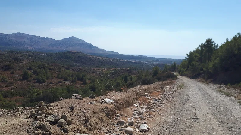
The route heads north east of Lardos towards the hills from whence the rivers drain. There are no difficult climbs although the route steadily ascends to some 100m on well worn tracks. This makes for a great way to lazily saunter in the heat of the day, taking in the sights, the panoramas, the sounds and the aromas of the wild herbs.
According to the Orama hiking map for Rhodes, the area to the north east of Lardos is marked with the Greek name κουνούπι
which is written as kounoupi
in the Latin alphabet and translates to English as Mosquito
. Whether this is some kind of warning that the area is infested with these nematoceran flies or just an adopted generalized name garnered from some obscure geographic feature is unknown. The area is certainly not swampy and there is scant water during most of the year so it is not the habitat associated with such an insect. The area is mostly covered with olive groves and little else other than scrub littered with wild herbs. Not the ideal location any self-respecting mosquito to consider setting up a home in. You are far more likely to come across these beasties in resorts.
The walk begins by following the river out of Lardos. When stating river, as in most cases on Rhodes this is no more than a dry gravelled river bed for most of the year. This river is commonly known as the Lardos River and is marked as such on some maps. The Orama map provides a name of φονιάς Ρ.
which in Latinised form becomes Fonias stream
and translates literally as Killer Stream
. The docile dry river bed appears to be no more than something that would ever contain anything other than a broad babbling brook and certainly nothing that would earn the name of a Killer Stream. First impressions can be deceptive and if one ventures further up stream there is a huge concrete dam that suffered severe damage during the winter of 2020 which goes to show what raging torrents can hurtle down this channel. The epithet Killer then seems to be appropriately descriptive of this watercourse.

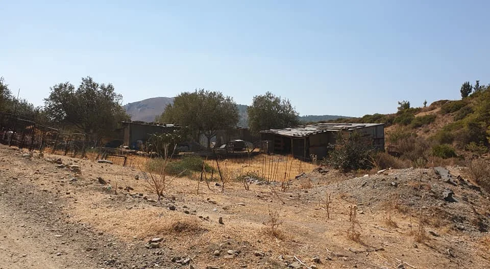
Our wander follows the track alongside the river. This starts as an asphalt road but soon turns to no more than a dirt track with olive groves and fenced smallholdings with the obligatory dog that will offer a bark as one passes, just to let you know that he or she is there. Chances are you will see no-one, and the rare occasion someone does pass it will be in a beaten up pickup with the window wound down, and without doubt they will slow down and declare in a broad voice kalimera!
.
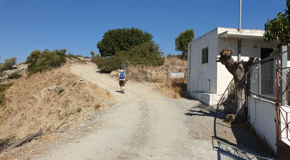
After 1km of walking from the river bridge in Lardos one arrives at a junction where tracks seemingly go in all directions. It is here that St Seraphim chapel is perched on a small hill, with a flight of steps leading up to the gate that allows entrance to the courtyard. This is unusual in the fact that it is painted yellow and white rather than the usual blue and white. It is thus far unknown whether there is any significance in the colouring.
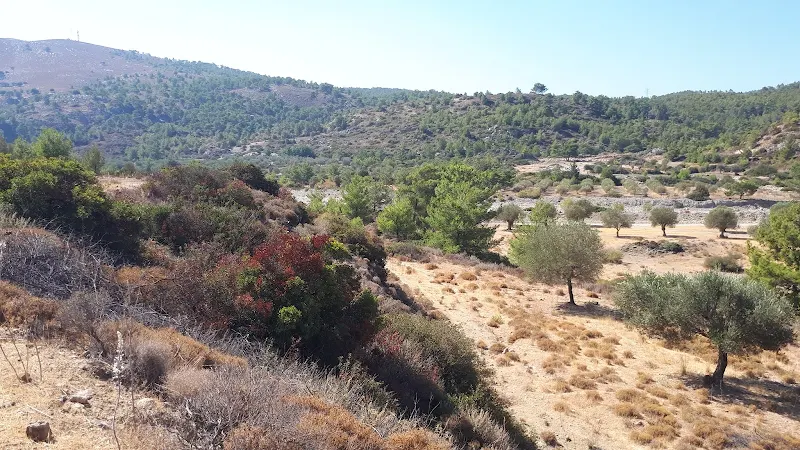
The route ascends on the track that passes directly beside the chapel to continue along a ridge atop a cliff that is difficult to appreciate due to the scrub. No doubt the cliff was created from centuries of winter waters that have plundered their way down the valley. To the right the olive groves continue although the trees are in more natural random patterns rather than the regimented lines that line the smallholdings passed earlier.
This track soon makes a sharp turn to junction with another track. A heap of rubble seems to block the way for anything other than pedestrians. This does not look intentional but the result of vehicles heading down the track or merely clearing of the route after rains have swept the rubble across its course. We head along the main track which steadily increases in height as it leads around a hill. A small track leads off to the right into the olive groves. This leads back down into Lardos at the point we left the village houses. This offers an alternative shorter route and one that omits the road walking we will encounter further along. But we continue a little further to explore a more of this landscape.
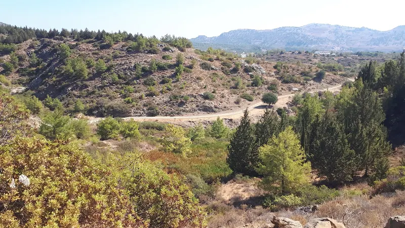
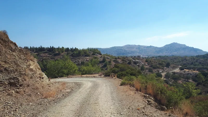
We now gain more height to reach an area of scrub to the right, and a junction that leads straight on into more hills. This point is about 100m and marks the highest point of the route. This is a vantage point where one can take in the panorama across the valley below with Lardos in the distance and the sea hugging the horizon, its azure blue almost fading into the blue sky above. As we look back, to the left one can see a track below that leads out of a valley and this will be the route we will take down. To get down to this the track we continue onwards to find that we are lead up a small valley where a hairpin bend returns us onto the track we saw from above. At this point there is plenty of evidence that waters obviously flow across the track during winter rains. A little further on, there is a more blatant dried up water course that sweeps across the track and into the valley below. No doubt when the rains comes this would be full of impressive gushing waterfalls cascading down the hillside.
The route now leads down the valley and onto the main road alongside a house. There is a continuation of the track which passes behind a house to head further down the valley. It is tempting to take this with the prospect that it leads back into the village through the countryside rather than take the road. Unfortunately there is no clear evidence that this is accessible, the route petering out in some olive groves below so it is probably no more than an access track. More investigation is required but we will leave this for another time.
The final hike is down the road. This is the main Lardos to Laerma road, a broad highway that curves gently up through the hills. Little traffic uses this, certainly in October when this walk was undertaken there was no more than a handful of vehicles that passed us. Asphalt roads are never the best routes for walkers and hikers to navigate along, but one should not discount using such thoroughfares as a means to an end. There are probably a lot of hiking purists who would scoff at such a walk, but a road provides sights as any other track or path and sights that are usually missed when travelling in a vehicle.
This road, as evidenced from its slow curving route that ploughs through the landscape with clear abandon and its broad run off areas for drainage, is most obviously a modern road. A result of bulldozers and machinery to force an even path through the hills, flattening the hills and bridging the valleys with embankments. One should take some time and study the sides of this and it soon becomes evident this replaced a much more rural lane, the original route to Laerma which twisted and turned around the contours of the hills with no urgency to take its travellers to a destination. Study the landscape and one soon discovers that the track by the house where this walk emerges onto the road was part of a twist and turn on the original route. On the opposite side of the road, just past the house is tarmac being taken over by nature that disappears behind a hillock before returning to the modern route. Further down as the road approaches Lardos, to the right the road cuts its way through a rocky mound with a cliff to the right. The original road negotiated a path around the contour of this hill to lead into the north side of modern day Lardos and then, with a sharp turn it would have returned back to the modern route. The old road is still there and we join it at the point where we depart the road walking and take the lanes through the village. I am sure any tourist motoring through this landscape would be completely oblivious to these hidden pieces of modern history, you only discover this by walking the road. The old route can clearly be seen on old maps dating from the Italian occupation in 1940, which can be found in the British Library website.
The route ends where it starts at Lardos village square. A gratifying drink and lunch can be obtained here to round off this simple amble. Like I stated at the start of this description, this is no more than a walk for walks sake, but without stepping out along such a route one would never ask the questions of the landscape.
Directions
A circular walk from Lardos to the countryside beyond
Leave Lardos from the square, taking the road that runs directly through the square heading south east, with the water fountain on ones right and Memories bar on ones left and heading directly ahead. Keep to the road until the last of the housing where there is a bridge across the river bed. Immediately before the bridge is a road on the right, take this which follows the course of the river. Ignore all other roads that diverge into the village housing. Where the road meets a junction with track straight ahead, take the sharp left, keeping with the course of the river. The road is now lined with small holdings and olive groves. Keep to this until there is a building on the left that stands next to a junction with a choice of three ways forward. Directly opposite is a flight of broad steps that lead to St Seraphim Chapel. Take the track directly to the left of these steps. This leads up an incline and passes the chapel with a gate into its courtyard on the right.
Keep to the track ignoring all other offshoots. It twists and turns but will end with a sharp turn to the right where it junctions with another well used track. Continue onto this track, bearing right to continue the slow ascent. Once again, ignore al other tracks off of this well used route.
The track will eventually climb to an area of scrub on the right with a track that leads directly ahead and another that bends around to the right bordering the scrub. Take the track on the right. This twists and turns, at one point leading up to a undulation of the valley where it hairpins back, steadily descending. Keep to this until there is a short branch off to the road beside a house. The road is the main Laerma/Lardos highway but little traffic uses this and there is a broad run-off drainage area that allows you to keep clear of any vehicles that may pass. Continue down the road which leads directly into Lardos. Eventually the road leads through a cutting the otherside of which are the first indications of the village and a road off to the right. Take this road, then the road that leads off to the right that IS NOT marked will a dead-end road-sign. This leads down to a junction beside the cemetery. Bear right, then bear left to walk around the cemetery boundary. At the far ed of the cemetary take the road on the right. This leads past the church and bears left to emerge onto the village square where the walk started.
Tavernas
Memories, Lardos View in OS Map | View in Google Map

- Address
- The Square, Lardos
The Facebook page for this village centre bar states Wonderful bar that serves breakfast and lunch, open all day and night serving amazing cocktails situated in the square of Lardos, come join us with any music of your choice!
This really encapsulates this lively and friendly bar. Always a cheerful welcome and what better place to sit, have a drink and relax watching the world enfold before you, not matter what time of the day or evening.
Whenever a ramble ends at Lardos, Memories is our place of choice for that long cooling drink to sooth all the worked up thirst from our adventures.
Image Gallery


Route Validation Cards
Validation Date - 06/10/2021
- Time of Walk: 11:30 to 13:00
- Validators: griff, kat
- Weather Conditions: very warm, blue skies
- Notes: Initial route undertaken
Summary of Document Changes
Last Updated: 2026-03-30
- 2021-10-28 : Original publication
- 2021-12-01 : Removal of ViewRanger links due to its imminent demise
- 2026-01-12 : Major website update with all walks recast to the new format


0 comments:
Post a Comment