Archangelos to Haraki, the easy route

A fairly easy walk to navigate even without a navigation app to give a flavour of rural Rhodes
Using well defined tracks and roads this walk allows even the causal explorer to see something of the wilder side of rural Rhodes. The route follows the coastline and being at some 150m provides great coastal views. The end of this walk is at Masari village, or alternatively one can terminate the walk at Haraki, reducing the distance by 3km.

Walk Statistics
- Start location: Archangelos
- End location: Masari
- Distance: km ( miles)
- Total Gain: metre ( ft)
- Total Descent: metre ( ft)
- Min Height: metre ( ft)
- Max Height: metre ( ft)
- Est. Walk Time:
- Walk type: Linear
- Walk Grade: Easy to navigate
- Terrain: Dirt/paved tracks
- Obstacles: There is nothing too demanding throughout this walk. The only places to take caution are on the dirt tracks that descend down the hills, one by the Chapel of St Mary and the other leading down from the hills to the scrub throguh to Agathi beach. These are full of loose gravel and stones, caution should be exercised in walking down these

Maps
The following maps and services can assist in navigating this route. There are links to printed maps and links to downloadable GPX route data for importing into navigational software and apps.
- GPX Route File
Accommodation
Pefkos Blue Studios, PefkosapartmentView in Google Map
- Website
- https://www.pefkosbluehotel.com/
- Description
- Pefkos Blue formerly known as Dimitri Studios, offering self catering apartment studios overlooking Pefkos village with splendid views across the bay. This is probably the best place in Pefkos if you want to be away from the village. Above the hubbub it offers unrivalled views and a quiet location.
Transport
Rhodes Public Transport - Bus Service
- Service Details
- Gennadi to Rhodes Town - KTEL Rhodes Public bus service serving the East Coast of Rhodes linking Gennadi, Kiotari, Lardos, Pefkos, Kalathos, Archangelos, Afandou, Faliraki and Rhodes Town
- Timetable
- https://www.ktelrodou.gr/
Walk Notes
The coastal walk between Archangelos and Haraki is liberally documented in a host of books and on many websites including Griffmonster's Rhodes Walks. Without a doubt this is a most spectacular and worthwhile expedition although it is quite an arduous hike, following stone cairns across the rocky clifftops. For the uninitiated to the Rhodes coastline this is one of those that has to be accomplished provided one is an experienced hiker and has the required navigational skills to undertake the walk.
For those who want to discover an easier option between the two villages, then there is a track that covers the same distance and is detailed here. This probably is not for the purist hiker, many who would squirm at the thought of following wide trails and surfaced tracks. But we are not purists at Griffmonster Walks and believe what counts are the views, the exploration and the experience of trying any walking expedition provided it is away from the masses and free from traffic. It has to be said that even with plenty of well defined trails, this walk is nonetheless well off the beaten track. On this occasion we never passed a single vehicle and the only people we encountered was an old Greek gentleman at the chapel of St Mary that is detailed below. The views are amazing along the coast, being some 150m above the coastline along the vast majority of the walk. This route certainly does compliment the cliff-top hiking route and as it is a lot more accessible and easier to follow, will allow many more folk to be able to explore without going out of their comfort zone.
The start of this walk is by the river bridge at the eastern end of the town of Archangelos. The bus route runs through the whole town and it is worth alighting in the centre of town and strolling through to the eastern end. Despite this being one of the principle towns on the island, it is still only a small community of well under 10,000 souls, but during the early morning it is a bustle of activity with folk going about their business.
The town is set under the rocky hills that separate it from the coast. On its north-eastern side of these hills, at some 217m, sits the ruins of a 15th century castle of the Knights of St John. The summit of this backdrop is some 516m and crowned with the chapel dedicated to the Prophet Elias. Back in the town, the principle church of Archangelos is St Michaels and its tall bell tower can be glimpsed between the buildings as one heads towards the river bridge. This structure stands some seven storeys high, with a bell on each level and a cross at the top. With so much to see it is always tempting to explore the church and the castle and climb the heights above the town but we will leave all that for another day and continue on our course. As always, on any undocumented first time adventures it is never known whether routes will be accessible and one always needs to allow plenty of time to find an alternative route if required. For those who are reading this then you have the luxury to know that this route was most certainly accessible in 2020 and can therefore plan with that knowledge in mind.
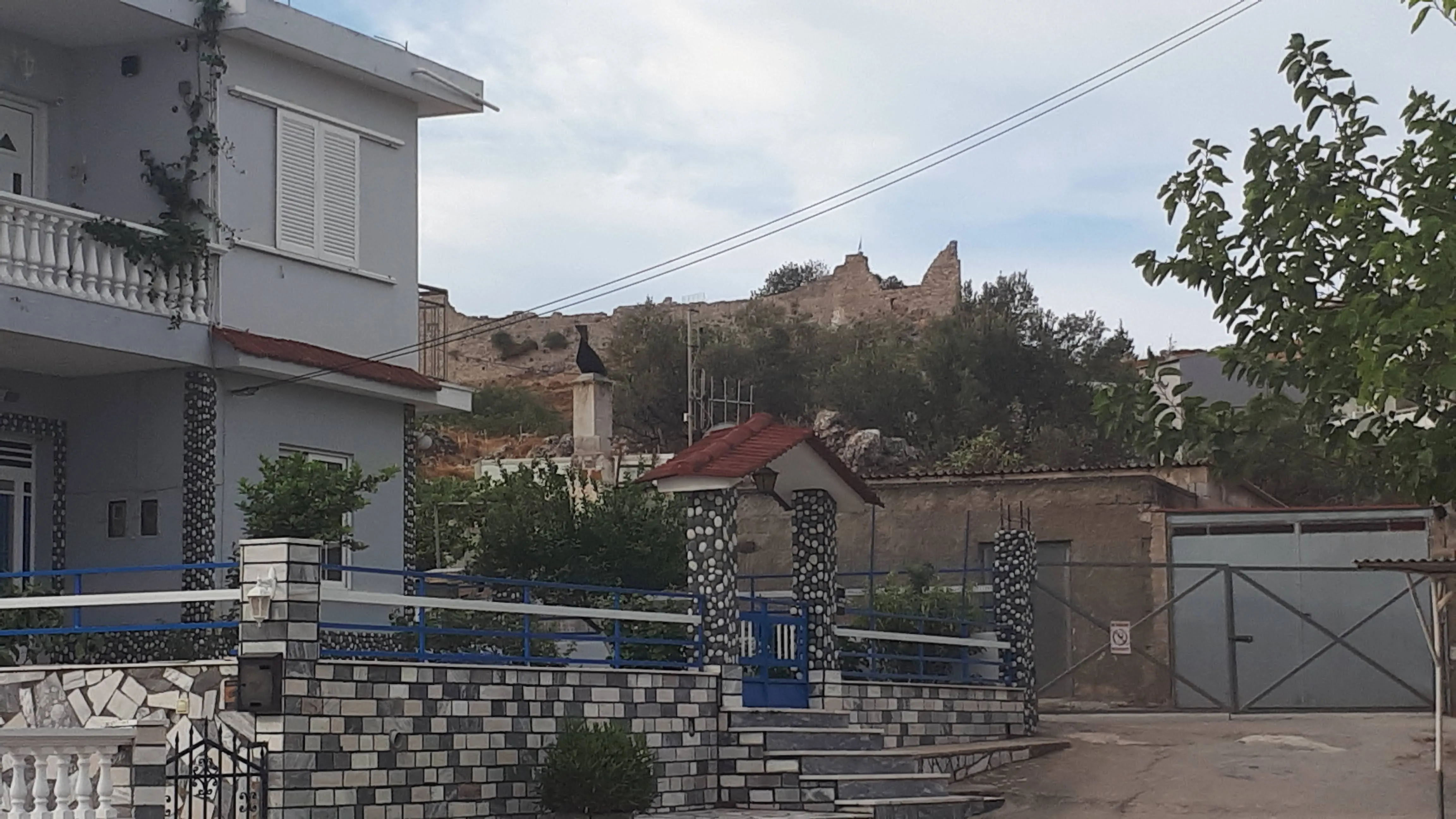
The river bridge is located at a crossroads just beyond the town centre. The road on the left will lead the intrepid explorer to Seven Springs, to the right is the main road through to the coastal village of Stegna. The bridge is merely a functional modern concrete construction and is easy to miss. It traverses a rather inelegant concrete channel that would lead winter waters down towards the coast. In early October it is dry apart from a dug out central channel where no more than a trickle of water runs. The Stegna road follows this channel and is the start of the adventure, with our route soon diverging away from the main road at a junction that leads through the domestic houses at the edge of town and then out to the countryside. The road is surfaced in places and other times no more than a dirt track but it is broad and easy to follow. To the right is the huge rocky mountain and the castle can clearly be seen perched on top.
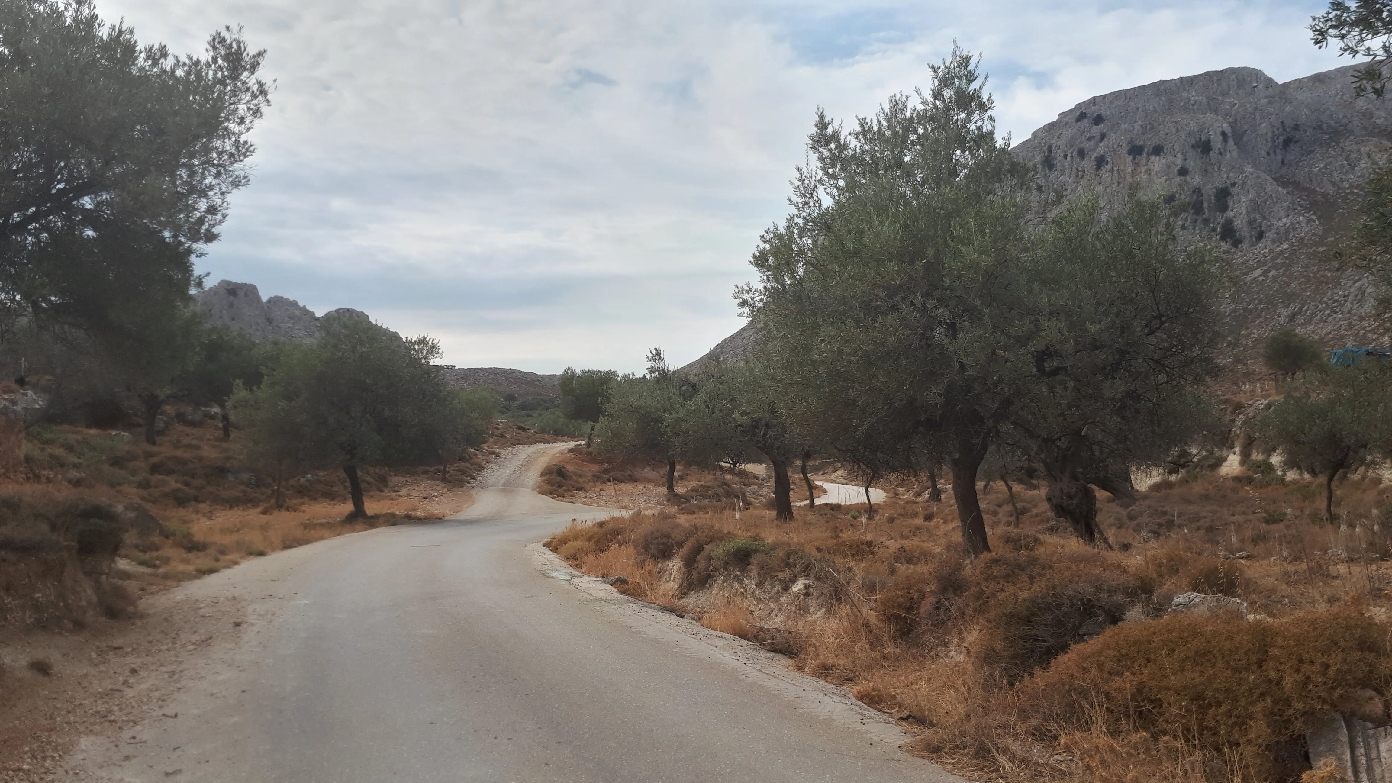
Initially the countryside is lush and green compared to other parts of the island. Olive trees scatter the landscape. The essence of herbs fill the air. Even with a somewhat overcast October sky this is a wonder to behold. To the left are the daunting rocky hills, an ever present feature that draws the eyes to their mountainous heights. I am not sure if these hills have a name. On the map the area this side of Archangelos is referenced as Keramí (Κεραμί), a district which is usually referenced in connection with the castle. Whether this includes the whole area of these hills is not known.
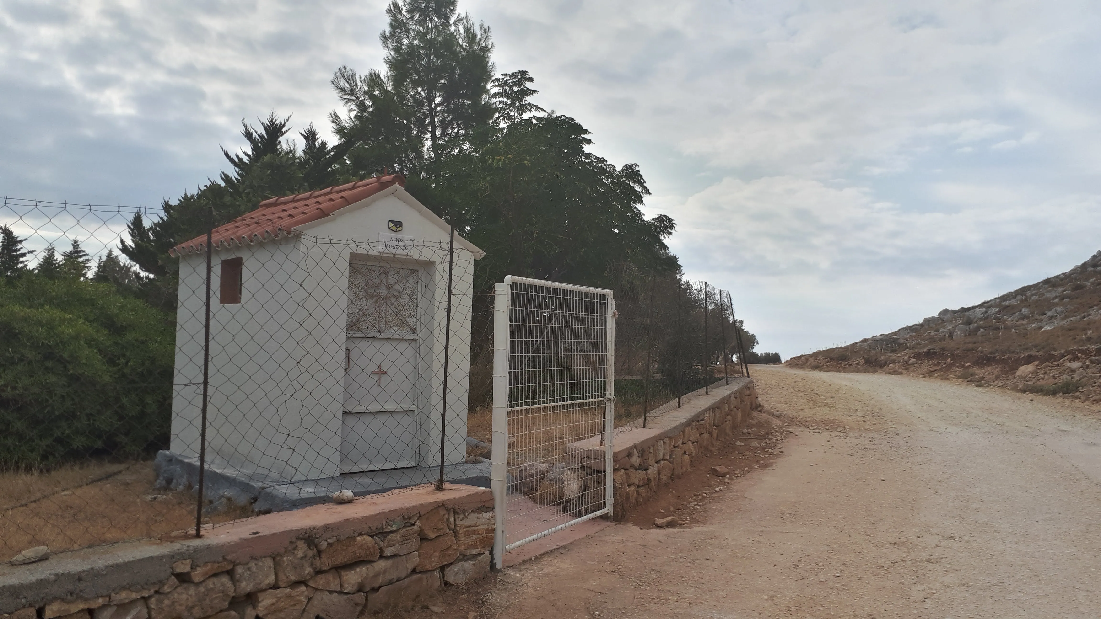
We soon come to a small chapel on the left. When I say small, this really is tiny, no bigger than a garden shed. A small garden shed at that. Above the door is a simple inscribed plaque that proclaims 'ΑΓΙΟΣ ΜΟΔΕΣΤΟΣ', a dedication to Saint Modestos, presumably the 6th century Saint and Patriarch of Jerusalem. A gate and fence bars entry. This is obviously someone's humble private chapel.
A little further on, the track descends down a hill and curves around a more grandiose chapel with a 3 tiered bell tower. This is the church of Virgin Mary Our Lady Epakousa (Παναγία Επακούουσα Panagia Epakousa), the word Epakousa having the meaning of the one who hears and receives our prayers
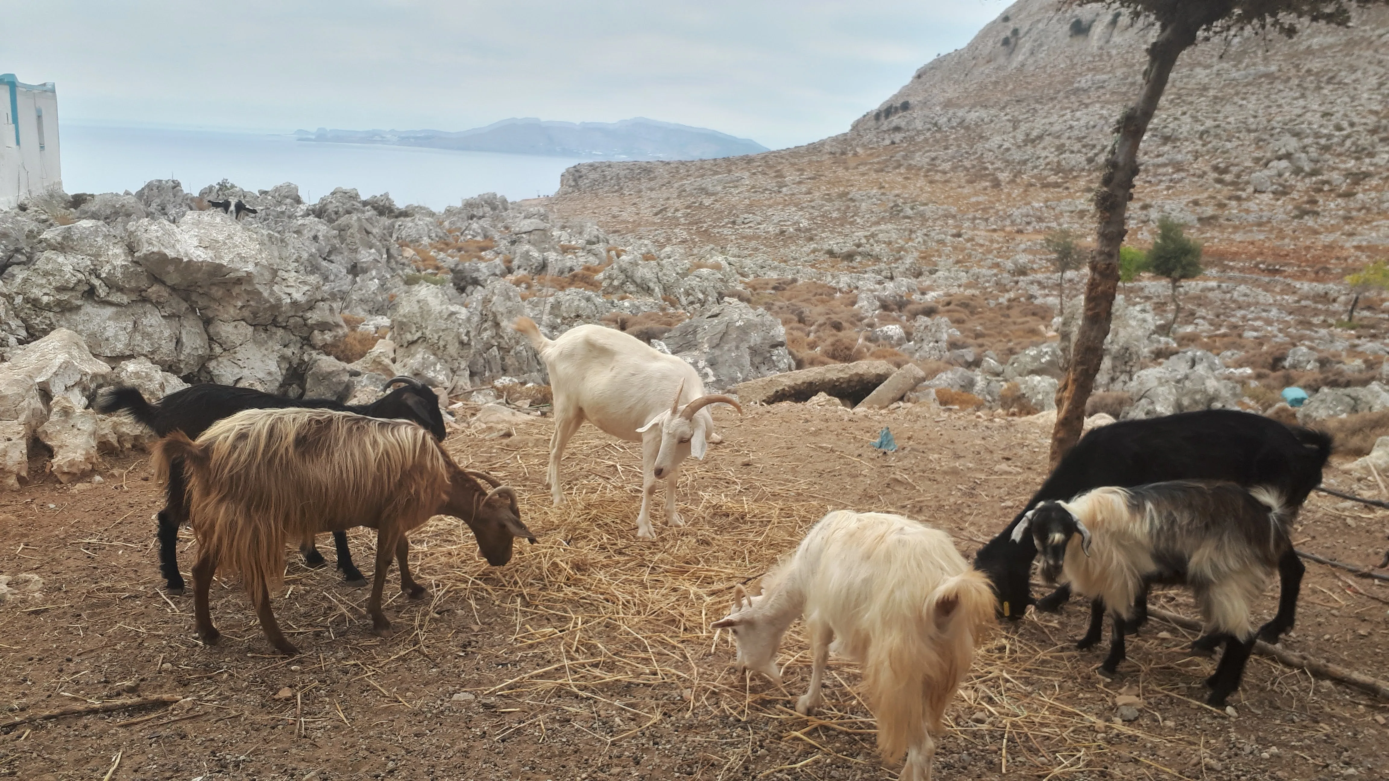
. In front of this was a tree where a herd of goats stood in its shade along with an old dusty moped and a little old man sitting by a small table, cap on his head, check pattered shirt and loose cotton trousers. His wrinkled tanned face told a story of a lifetime of being out on the land in the sun. He arose as we approached and offered a greeting which was a sort of Greek, German and English hybrid language. A few questions in the hybrid language determined that we were English and not German and with that the language was restricted to a Greek and English hybrid. His gnarled face offered a smile and he took a few leaves of basil that he had clutched in his hand and thrust them upon us. I am not sure if this is a traditional Greek greeting for strangers and whether there is any significance in basil. Even so, it is touching. The old man led us towards the chapel. Then stopped. Turned to face us. Announced that he would sing us a song and without further ado launched into an acapella rendition of what may have been either a Greek hymn or folk song. His brazened vocals navigated through the well rehearsed notes, the rasping words issuing out from his weather warn face. The tone and key never wavering to adventurous heights or depths but ushered around the mid tone of his gravelly voice.
The song terminated and a few words attempted to explain what the song was or its meaning but all explanations got lost in the hybrid language and he motioned to follow him further as he plodded towards the chapel door which he pushed open to allow us entry. Like most chapels on this small island, this interior was richly decorated in bright vibrant coloured frescos and icons. A delight to the beholder, where the eye does not know where to settle as there is so much to take in. As we stood there in admiration he took two tall slim candles and lit them from another candle that was flickering away, mounted on a plate on a small table. The candles were offered to us and we planted them into the soft substance that kept the candles in place on the plate. The man seemed to indicate they were meant for family members departed from this earthly world. I believe this is a traditional practice in Eastern Orthodox churches. This action was followed by the old man moving to the right hand side of the iconostasis where he ceremoniously stood under the icon of the Theotokos, the Virgin Mary, and issued a lengthy prayer in an unwavering monotone voice, his head held aloft, his eyes closed. For you
, he said at the end, a prayer to Epakousa for our well being, and he rejoined us to usher us out of the chapel.

Once back out into the warm bright day he stopped to tell us more about the chapel, describing how his son had built it and he was now the caretaker. This culminated in expressing that it required much money for its upkeep and the family had little. This was obviously a request for donations and we could not let him go empty handed so furnished his hands with the change from our pockets. . His head bowed slightly as he accepted the gift then beckoned us to the end of the open corridor between the chapel and an outer building. He led us through the open door and into the confines of the small humble abode which was obviously his living quarters. A simple makeshift kitchen sink sat beneath the window that looked out across the coast. What a view to have. A large double bed pretty much blocked access to the sink and was adorned with a hoard of icons mounted on wooden bases and laid out in ordered fashion on the bed blanket. To the right of the bed, against the far wall and on a table sat an old portable television set. A prize possession it seemed, judging by how he enthused that this was a new acquisition and kept him company during the evenings. This really was a humble abode.
He picked up one of the icons from the bed. Five euros
, he offered it to us. A sales pitch. We could have said no. But a few euros for a small icon was little to us, and probably a huge amount to him. A note was produced and placed in his palm. He was grateful. Very grateful. We were given pomegranates. And with that we were escorted back out to continue our travels, stopping momentarily to admire the ornate whitewashed wall bordered in blue decoration where a centre piece of a water fountain was being guarded by a goat.
Reading the various reviews of this chapel on Google Maps it looks like this is a well rehearsed routine that the little old man uses on passers by. Some have indicated that he is named Stamatis, and there are several comments to the effect that it is nothing more than a money grabbing exercise. That is as may be, and yes, he does request money, but think of it this way, of all the chapels we have visited on Rhodes we are rarely asked for any donations. Many, including this chapel, I assume are private constructions built by families and on previous occasions we have walked past its confines have been locked. So to view it is an honour, and to have someone sing for you personally, to mediate prayers to their saints for you, and to show you round their abode is so much better than merely providing an entrance fee and an impersonal experience. Yes, the icon we bought was only a print mounted on a wooden plaque but it was a token gesture to buy it from him. All of this cost us under 10 euros. That must be huge amount to a humble old man. Yes, he could have been taking us for a ride and we could have arrogantly declined the invitations, but maybe not, maybe he really was just a simple humble man making a few Euro for the upkeep of his families chapel. Trade must be few and far between for him on the side of this dusty old track where few attempt to wander. Having said this, there is a secluded beach that can be accessed via this track which appears to be a secretive tourist haunt. Given all this, isn't it worth giving a few euro to a local man for the hospitality along ones journey? After all we are passing through his land, his country, his domain. It was a quite unique experience. Savour it. It will be a memory for years to come.
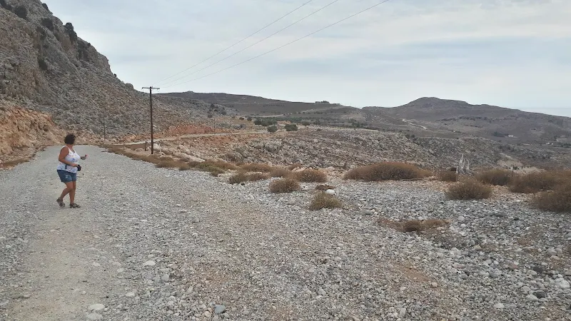
We continue onwards and the track leads down some 50m on a fairly steep incline where loose rubble underfoot causes the boots to occasionally slip with the threat of toppling onto ones backside. At the bottom of the incline a well used track leads off to the left, to Stegna although some reports have said the route to get down to the sea front has been blocked up whilst other walking websites discard the route on account of it now having a surfaced road. We intend to find out ourselves some time in the future. To the right a dirt track continues over to Haraki, slowly rising back to the 150m level. Soon after, another track branches off. This leads down to the rocky route that follows the coastline to Haraki, it looks easy walking and indeed the first part is. A simple arrowed sign directs one down this track to St Antony's chapel after which the track deteriorates to a path and then to no more than a rocky surface which one has to clamber across. A great adventure. But today we are on the easy route.
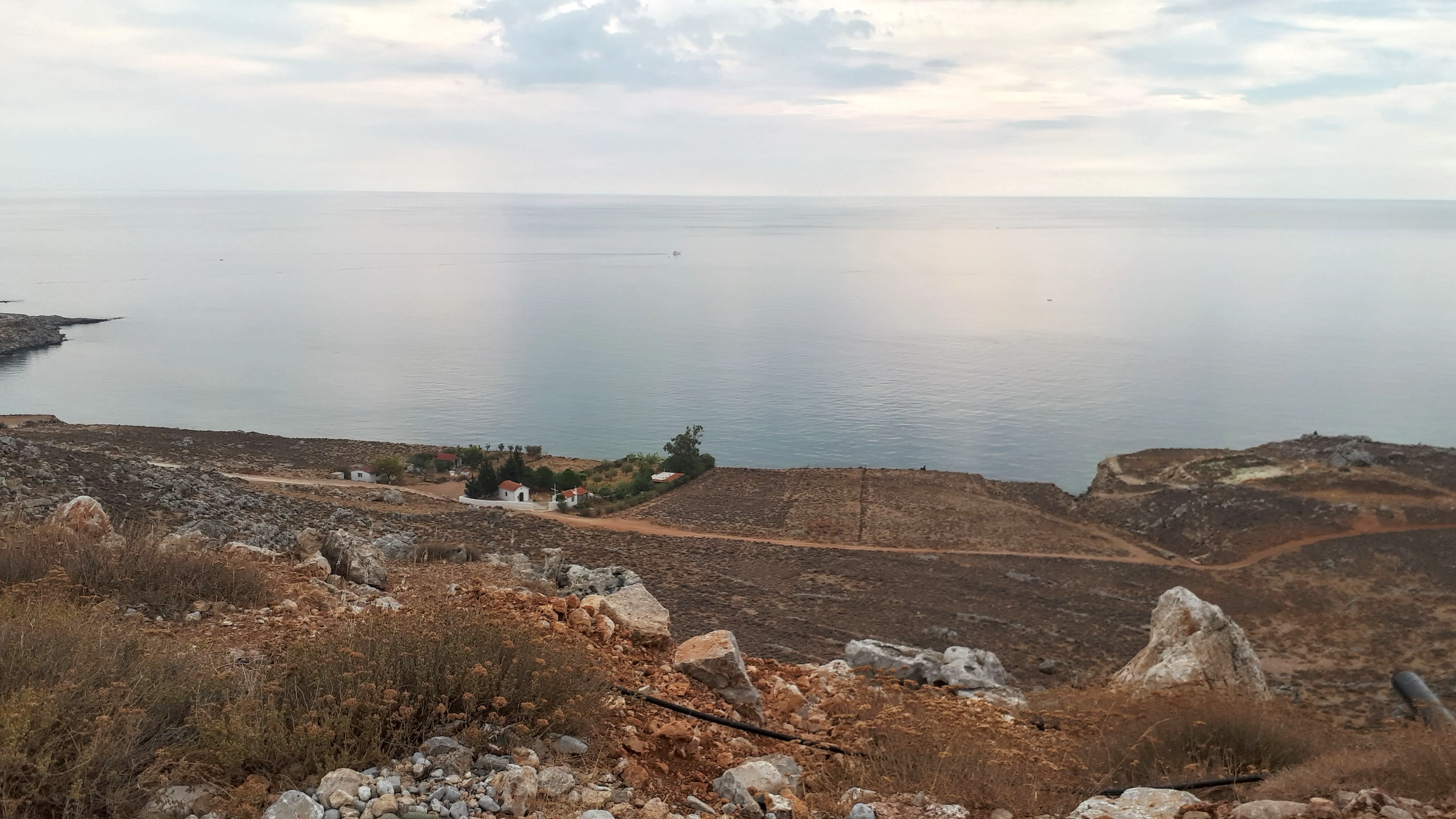
We continue along the main track which is no more than a dirt track although wide enough to allow for vehicles passing in opposite direction. The gravel underfoot in places bears witness to tyre tracks but is certainly not well used. No vehicles pass as we march onward, not even the ubiquitous moped often encountered in the rural areas of Rhodes as villagers head to allotments and small holdings. There is not a soul around for miles around. But then the landscape along this section is pretty much barren with little in the way of areas of cultivation where the odd tree and herb attempts to eke an existence from the dry rocks. Ahead are views of the coast as it snakes into the distance with rocky outcrops and cliffs along its course. In the distance is the Lindos peninsular which stretches out into the deep azure sea and provides the backdrop to this coastal panorama.
The road is lined with what look like telegraph poles. Leading onward, into the distance in both directions. Like some movie scene of the long straight roads of continental America that are always lined by such poles. On closer inspection these are not telegraph wires but electric lines. The road turns a sharp double bend, and after the first turn it reveals a nondescript concrete structure. Single storey. No windows. No identifiers. Just a plain grey building with no obvious specific purpose. The electric lines bypass it so it is assumed that it has no electric supply. The rocky landscape appears to be cut away to allow the road past and for the building to have been placed there. Therefore there must be some significance to it. It has the feeling of a secret tucked away outpost, hidden away on the double bend and secluded from view by the mounds of rock that have been cut through. But its existence is probably a lot more mundane and is probably no more than some kind of storage unit.
The road then turns back out of the double bend to reveal a steep hill down to the broad plateau bordered by the inland hills and mountains to the right and the coast to the left. The view is amazing and it takes several minutes of gazing across this before starting the descent. This is still a used road despite its broken surface. It almost certainly has had vehicles heading up and down as their tracks can be easily picked out. Even so, with the crumbling loose gravel underfoot and the steepness of the descent it makes one wary of treading carefully to prevent slipping and ending up on ones backside. This does raise the question of whether some vehicles do not make it and end up slipping back down. The well defined tracks seem to indicate a lot of slipping wheels.

Eventually the track flattens and the barren rocky land gives way to trees and wild herbs. Ahead is what looks like a grey hut. As we approach, it is uncertain whether it is a weathered concrete hut of just a huge cube of concrete. On the facing side are two arrows that conjoin, scrawled in black paint, pointing away from the track. This was obviously the way to Agathi beach and beyond to Haraki, this was also confirmed on the navigation app as being the route we should take. Not really a suitable route for your pretty average hire car as it was no more than a rough dirt track that cuts through the scrub. We head along it and come to a rocky hill that rises several metres above us, barring views to the coast beyond. And there parked under this mound of rocks is a pretty average hire car. Just sitting there. Folks inside. Probably followed the big black arrow and now wondering exactly where they are. We give thanks to Zeus and all the other Greek gods that we do not seek adventure in a hire car as we are confident that our way ahead will be accessible.
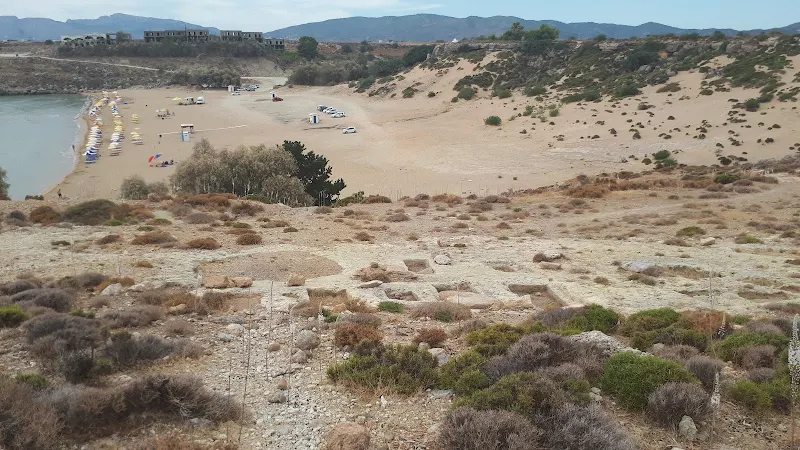
The track leads to the junction where a rough path zig zags down the cliff to Agathi beach. This track is mentioned on other walks on this site and it should be noted that at the bottom of this descent the access to the beach is barred by a fence. In more recent years this fence has been suitably bent to allow walkers to get through. The reason for the fence appears to be the tombs that litter the cliff side, all excavated and presumably dating from the Mycenaean period. Ancient. They are shallow, no more than small holes in the rocky ground and not what one would associate as a tomb. There are tens of these. The size of each them is no more than what could contain a small child. These could be either a shaft grave which would allow the body to be buried vertically, or more likely judging by the shallow depth in this case, what is known as cist graves, where the ashes of the deceased were placed. Both practices were employed by the Mycenaean civilisation. The tombs are easy to pass without even realising their ancient status, but it is worth stopping and reflecting on the sheer age of these. Thousands of years old. Below this is the Agathi cave chapel together with further caves going under the cliff. It does make one wonder if all of this site may have had ancient religious or ritual connections that were later adopted by the Christian church.

We get down to the beach. It is virtually empty. Unusual. Under normal circumstances this is popular place for sun worshippers but these are not normal times. Covid 19 has seen to that with this specific adventure taking place during the dreaded year of 2020. Despite this, Rhodes was sufficiently free of the virus although access to the island was restricted and many had stayed away. The beach spoke for itself, with few cars parked on the sand, few sun beds, and virtually nobody soaking up the sun. The usual kantinas with shaded seating had been reduced to a single trading trailer and a large parasol. Hard times for business.
We carried on through, taking the road by Feraclos castle and then the path down to Haraki. We could have stopped for lunch but it was early so we continued onwards, stopping at the Masari crossroads for a beer, then having lunch at Masari's Rendez Vous taverna where we were treated with locally caught little fish, an enormous plateful of fish similar to whitebait together with a meze of Greek dishes. A fitting end to a days walking.
Directions
Simple navigation along tracks to provide a route that most folk can undertake
There are several bus stops in Archangelos. Alighting at any one of these, head eastwards, in the direction for Rhodes town, along the main street. Keep walking until you come to a paved area on the left that contains two plinths on which are mounted a bust. Just beyond this is a crossroads after which is a conrete bridge across the river, although not easily discernable at first sight. Take the right hand road.
After 170m take the road that diverges off to the right, leading up the hill. Follow this as it curves around a slow bend for 250m. Take the left fork that lead out of the town and into the countryside. Keep to this avoiding all other turns, following the main track.
Eventually you come to a chapel on the right with a bell tower. Soon after this the track descends down a hill. At the bottom turn right. Keep to this track and ignore all other turns. After some 1.5km there will be a sharp double bend and the track will descend a steep hill. Keep going straight ahead until there is a large concrete block with arrows pointing off to the left. Follow the track these point to. This heads towards the coast then turns sharp right by a rocky hill. After some 400m where the track turns right take the left hand track/path which zig-zags down the hill to the beach. At the bottom is a fence will just enough room to squeeze through and emerge onto the beach.
Traverse the beach and take the road at the far end, turning left as it emerges out from the beach. Follow the road through to the turn where there are steps to Feraclos Castle. At this point the road makes a right turn. Go straight ahead onto a footpath that leads across some scrubland. This emerges onto the back road to Haraki village sea front. Take one of the alleys through to the beach and follow the esplanade around to the far end where it joins a road. Keep to the road until it junctions and take the left across the river bed. Follow this road through to the Masari cross roads on the main road. There are bus stops either side of the road.
Refreshments
Rendez-vous Bar, Masari View in Google Map
- Address
- The Square, Masari
Taverna in the centre of Masari with street seating under broad trees that form a welcome respite from the heat of the day. A great place to sit and watch the world go by. The owner also has a beach front taverna at Haraki.
A great place to finish the hike, shaded by the trees and adjacent to the bus stop. On the menu on this occasion was 'little fish'. Locally caught fish similar to whitebait that were a delicious treat and just the right thing to make a satisfying snack for the time of the day, washed down with retsina.
Image Gallery

Route Validation Cards
Validation Date - 2020-10-08
- Time of Walk: 09:00 to 13:00
- Validators: Griffmonster, Kat
- Weather Conditions: Very warm but overcast day
- Notes: Initial route undertaken
Summary of Document Changes
Last Updated: 2026-03-30
- 2021-02-14 : Original publication
- 2021-03-17 : Update website improvements and removal of ViewRanger reliance
- 2021-12-01 : Removal of ViewRanger links due to its imminent demise
- 2026-01-12 : Major website update with all walks recast to the new format


0 comments:
Post a Comment