Masari River Valley Circular Walk
A circular walk following the river valleys around Masari
A walk of exploration into rural Rhodes that is not too arduous, this route follows the river valleys around Masari to make a 7 mile circular route. Some lush Rhodes countryside and great views that is not too strenuous and fairly easy to navigate.

Walk Statistics
- Start location: Masari
- Distance: km ( miles)
- Total Gain: metre ( ft)
- Total Descent: metre ( ft)
- Min Height: metre ( ft)
- Max Height: metre ( ft)
- Est. Walk Time:
- Walk type: Circular
- Walk Grade: Easy
- Terrain: Dirt tracks, stony river beds with a short section of road walking
- Obstacles: Simple and fairly easy walk

Maps
The following maps and services can assist in navigating this route. There are links to printed maps and links to downloadable GPX route data for importing into navigational software and apps.
- GPX Route File
Accommodation
Pefkos Blue Studios, PefkosapartmentView in Google Map
- Website
- https://www.pefkosbluehotel.com/
- Description
- Pefkos Blue formerly known as Dimitri Studios, offering self catering apartment studios overlooking Pefkos village with splendid views across the bay. This is probably the best place in Pefkos if you want to be away from the village. Above the hubbub it offers unrivalled views and a quiet location.
Transport
Rhodes Public Transport - Bus Service
- Service Details
- Gennadi to Rhodes Town - KTEL Rhodes Public bus service serving the East Coast of Rhodes linking Gennadi, Kiotari, Lardos, Pefkos, Kalathos, Archangelos, Afandou, Faliraki and Rhodes Town
- Timetable
- https://www.ktelrodou.gr/
Walk Notes
Like many of the walks on this site, the impetus is often provided by chance discoveries, a casual word in a conversation or a passing reference from a local villager. In this instance a chapel was glimpsed in the river valley as viewed from the summit of the Masari mountain that sits to the north west of the village. Following this discovery, a chance encounter with a village resident qualified that it was possible to walk right around the base of the mountain and this led to researching a possible route on available maps.
The result of that research is defined here and leads the avid rambler on a fruitful wander through the Rhodes countryside following the river valleys. The starting point is the Makaris river which separates the villages of Masari and Malona and whose source is up in the hills around Platania. During most the year the river is just a dry stone bed and serves as a route for the farmers and small holders whose groves lie in the valleys around the river.
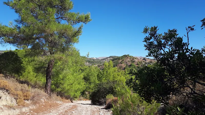
The route then leaves the Makaris river and cuts across a valley between the hills, joining up with a tributary of the Skoutouljaris river to make a full circumnavigation of the Masari mountain. This walk is not particularly difficult and following the valleys has little in the way of steep assents. The area is lush in vegetation with numerous olive groves, pine trees and fruit trees as well as bountiful wild herbs. Wildlife is also abundant with deer encountered upon this occasion in addition to the numerous wild goat herds that roam the area. The route is easy to follow and accessible to anyone of average fitness.
The first section of the walk out of Masari village may be described as somewhat mundane, following the road northwards towards the village of Malona. This is easy walking, although, as for any walk that navigates down an asphalt highway, it does seem a somewhat laborious task. Having said this, there is little traffic that uses this road and this will soon be forgotten once one ventures out into the wilds. It is always best to get the more mundane out of the way first.
We now cross the bridge across the Makaris River, the vast dry bed below showing signs of vegetation springing up despite the torrents that the previous winter saw cascade down here. Just beyond the bridge a road leads off to the left to follow the course of the river. We take this. Ahead the river bed leads between two hills, a small gorge cut between them by the waters. The surfaced road veers off to the right with a signpost for Platania and ahead the road deteriorates as it leads towards the gorge. Another sign points into the gorge. Its yellow characters on a blue background read ΖΩΟΔ ΠΗΓΗΣ ΑΓ. ΝΕΚΤΑΡΙΟΥ
which appears to translate as a direction marker for St. Nectarios. Is this the chapel that we are heading for? The sense of adventure kicks in.

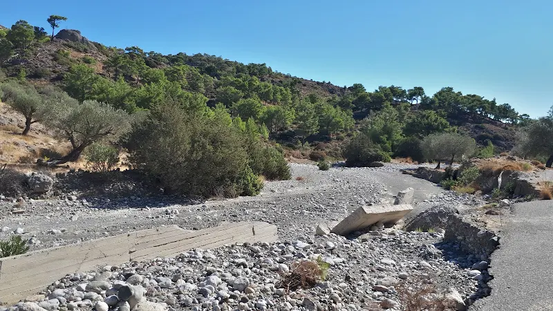
One gets the feeling that a road once used to continue alongside the river but has been washed away. The huge concrete remnants that litter the river bed certainly indicate some structure was once evident here. The track we follow is now nothing more than a route of compressed stones that leads down onto the dry river bed, the rutted wheel tracks in the rubble underfoot evidence that it is well used. Just beyond the gorge appears some sort of compound on the left of the river. We come to a fairly steep ramp that leads down to the base of the river bed. Ahead we could make out a pick up truck passing the compound and heading towards us. We wait to allow it access up the ramp.

The truck approached ever closer, bumping up and down along the stony track. It came to the ramp and the engine revved as the battered old waggon heaved itself up and out of the gulley. It got to the cusp of the incline and came to a standstill right bedside the two of us. Both windows on the cab were wound fully down and inside were the beaten weather worn faces of a man and woman. Faces of a lives spent under the sun, the lives of outdoor rigours and hard labour. Skin wrinkled with age and chins full of stubble. Both of them, like peas in a pod.
They both stared at us, a sight obviously not often encountered on this outback track. The man spoke a few words in Greek. A response made it clear we did not understand. German?
he asked in the best English he could muster. English
we responded. More Greek words followed, interspersed with a smattering of English along with approving facial expressions. Maybe mixed with some sense of amazement that these mad English tourists had strayed from their sun loungers on the beach. He opened up the drivers door and attempted to alight the truck. The truck attempted to career back down the slope. He pulled himself back in and fiercely struggled with a stubborn hand brake. With a little more caution he alighted and the truck stayed in place. More words issued in Greek with a smile and waving arms to assure us the van would now stay put. He took a couple of steps to the back of the open truck where a pile of ripe melons lay. He was obviously taking them to market, the fruits of a years labours tending the ground somewhere up the river. He picked one of them up, turned to me and pushed it into my chest. I had to take it, there was no way to refuse such a gift. The smile on his face was enough to see that our thanks was appreciated. He got back into the truck and with waving arms they set off down towards the tarmac road.
Without a doubt, anyone who encounters such friendly hospitality can only be taken aback. These humble people who could have little other than the crop they grow and the truck they use to take it to market have a generosity without bounds. Salt of the earth people. Where else would you get such an honest and heartfelt welcome to two strangers? This is the real folk of Rhodes. Away from the tourism and the hoards, this was real Rhodes. The melon was bundled into the rucksack and we headed off up the river.

We head further into the gorge, on the right a flight of concrete steps lead up to the top of a structure that has clearly been washed away. Maybe some sort of dam or obstacle to restrict the flow of water. A lorry heads towards us along the river bed. A large 8 wheeler tipper truck, the sort of 32 tonner used for transporting aggregate or stone. Dust adorned the truck in a cloud that never strayed far behind it. Its load was masked by the high sides, if there was indeed a load as he may have dumped that and was on a return journey. We stepped off the track and onto the uneven river bed to allow him past and a wave of the hand was returned in thanks. Of he trundled, up the ramp and out towards civilisation.

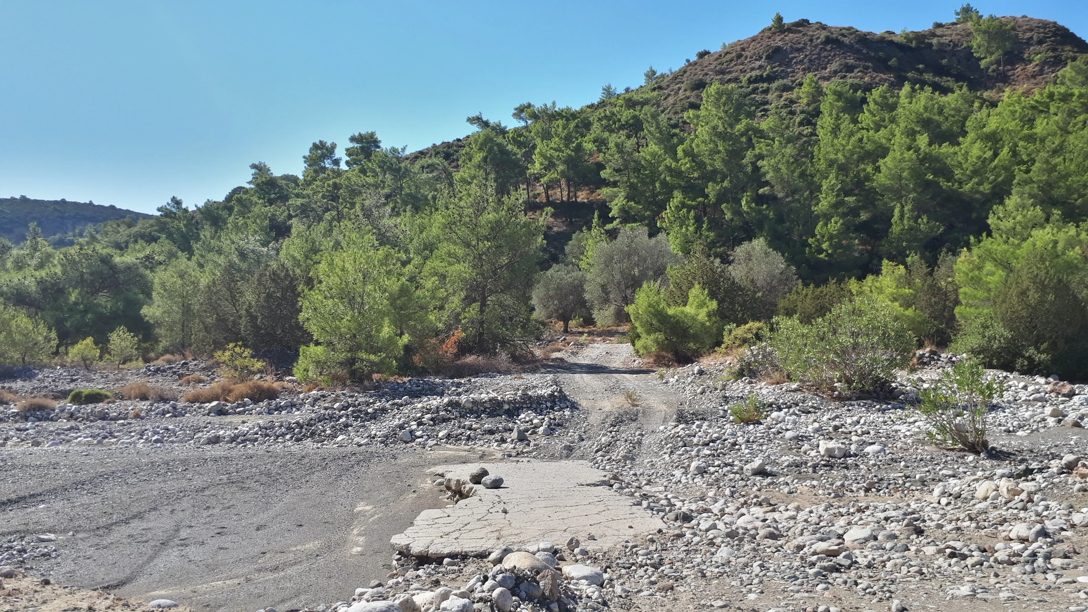
Beyond the short gorge area, the river bed becomes wide and sprawling across an open valley where its course twists and turns with no clear aim other than to find a way out. Large heaps of spoil either side of the track indicate the effort that was involved in digging this out after the previous winters exceptional rains. The track runs close to the left side where a small cliff creates a border and the right is just a vast expanse of curving river bed. The track then cuts across to the right hand side of the river and up onto some scrub whilst the river flow dragged debris across a wide arc to the left. When the track leaves the scrub the river bed has twisted back round and the route leads directly across the river and onto the opposite bank with no discernable ramp to get there, just a slow rise in the stone debris.
We now head away from the river into the fertile valley between the hills. Directly ahead is a little shack. Nothing more than a tumble down shelter built from discarded debris and surrounded by sundry other remnants such as plastic chairs, metal drums and a neglected ramshackle van whose doors vacantly stand fully open. Not a soul about. Seemingly abandoned but no doubt some farmers refuge away from the heat of the day.
Bearing around to the left we come to a small chapel surrounded by a whitewashed wall that is topped with metal fencing. This was the chapel seen from the summit of the mountain on the previous years expedition, the chapel that had prompted this very walk. Was this the destination of the sign that pointed into the river gorge? Was this St. Nectarios? There was no clear indication to whom this chapel was dedicated to. The gate to the compound was kept closed by a heavy stone and inscribed into the concrete in front of this gate was a symbolic bird alongside a heart within a heart. Although moving the stone allowed access to the compound, entry to the chapel was barred by a locked door. There was a key in the lock but it would not turn and I didn't want to force it. A slit window at the rear allowed little to be seen inside and a simple bell hung under a T-frame to the front of the chapel. The bell was rung. A single clear chime. It resounded around the hills and they echoed back their approval. It could not be helped but to see that a figure cast into the metal of the bell depicted a man on horseback thrusting a sword downwards at a dragon below. Was this St George? It certainly bore a resemblance to other Greek depictions of St George whereas Nectarios was a 19th century wonder-worker from Aegina, a Greek island in the Saronic Gulf, who was canonised in 1961. As far as I can tell there was little call for dragon slayers in the 19th century so maybe this was a chapel dedicated to St George. If so, then we must ask where was the chapel of St Nectarios?

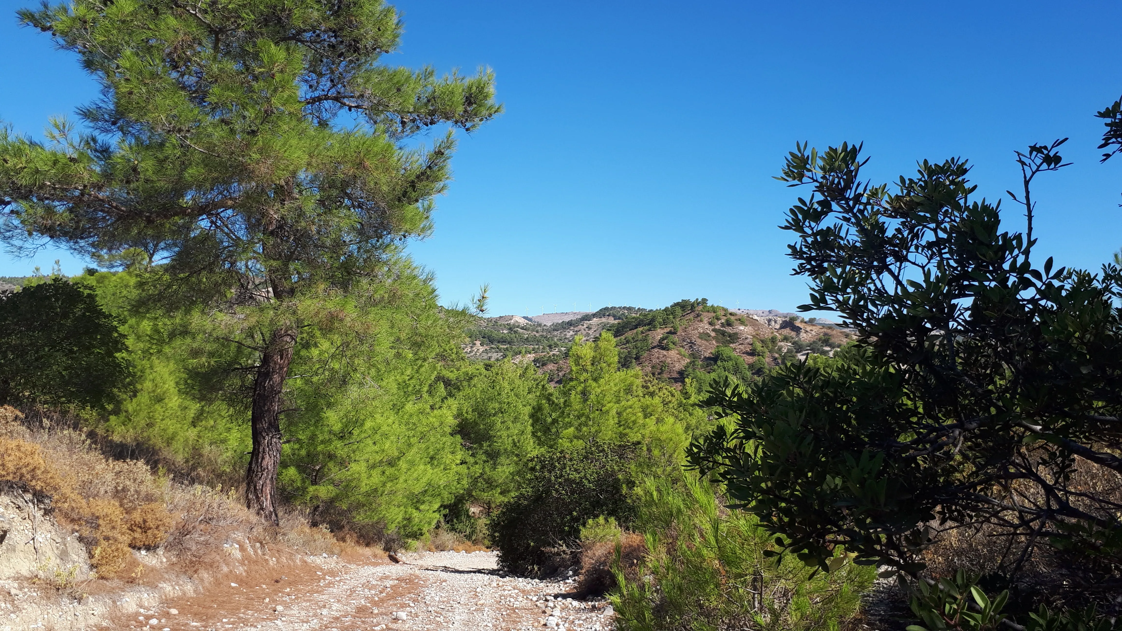
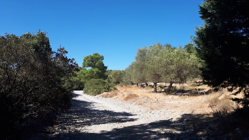
We now follow the track through the countryside. The going is fairly easy as the route meanders through the pine trees and olive groves. The area is rich with life, the whole scene sat within the boundaries of higher pine clad hills. Two deer casually wander across the track ahead, stopping briefly to cast an eye in our direction. They leap down into the scrub and despite cameras at the ready they are too quick and then too far away to capture the moment with any definitive detail. It doesn't matter, the mere sighting was all that was needed.
The track leads onwards, rough and ready but wide enough to accommodate a vehicle and the giveaway marks that small trucks and mopeds have have used this route. All around, the stony ground is abundant in growth. It seems remarkable that such barren soil can bear so much life. Trees are everywhere, their foliage so thick on the hills that the ground can not been seen. Everywhere is littered with wild herbs, oregano, sage and abundant amounts of coarse wiry thyme, their scents filling the air. Occasionally a chain-link fence forms a boundary to an olive grove. What makes this grove so special with respect to the numerous other unbounded olive groves is unknown. We catch a glimpse of a large round glass jug tied to a branch, this captures the sap and is used to make Mastika liqueur, something to finish the best of any Greek meal with.
The remains of a stone wall sits by the side of the track. A ruin. No higher than waist height. It beckons the imagination that it may once have been a shepherds house. Or more likely a goat-herder. Whatever it used to be is now long gone, reduced to a few stones and the rest hidden by the wild herbs that have taken over, reclaiming the earth as their own.
The going is easy. The track, although rough, is easy walking but care should be taken with the loose stones that litter the way. Occasionally a gulley provides evidence that winter waters have streamed through and in extreme cases they have torn through the track. This may hinder any vehicular access but offers little obstacle to walkers. The track stays around the 100m level, therefore there is little in the way of gradients to navigate up or down. One exception is where the path descends down into a lower valley. It is not steep. Ahead lies a mass of tree covered slopes and the track levels out to navigate through this. Eventually the track reaches the dry bed of a stream and follows this down until it meets what would have been a river.

Crossing the river, we emerge out onto the road that leads up to the Kamiri Monastery, nestled somewhere up in the hills above, but out of sight from this vantage point. The road follows the river bed, a tributary to the Skoutouljaris river which we soon encounter as the road crosses over the main river course, as ever completely dry. To the right the course of the river leads into an amazing high sided gorge, one of the wonders around this part of the island, the spectacle liberally publicized in tourist paraphernalia. A line of cars appear abandoned by the roadside, parked with no reverence. They are all hire cars. Most likely tourists seeking out the gorge. The drive up here. Walk into the gorge. Marvel. Tick it off their list of sights to see and head onwards to the next item on the list. Maybe that is all too harsh, maybe they do venture further. Maybe some do go to the effort of navigating through the gorge and return back via the Kamiri Monastery which is a fair hike in itself.
The road back down towards Masari is now properly surfaced. Even so, there ar parts where distinct cracks have appeared in the tarmac on the river side. There is little to hold this together and stop it plunging into the crevasse that the waters have eked out below. It is with grace that we give thanks that we are walkers and this is easy to see and keep away from. Tall cliffs reach to the sky on the opposite side of the road. In their sides are caves. Hidden depths that look to have been bored out by the elements. Above the cliff three faces stare down. Slit eyes. Goats. Watching our every move. It is always amazing how these beasts have no fear of heights and how their hooves cling to even the slimmest of ledges. They watch us. We try to take a photo. They are camera shy. Another moment to preserve in ones memory and not to capture into some electronic device.
A concrete dam once attempted to hold back the waters of this mighty river. The concrete has been cast asunder as if a giant had kicked it in a bad fit of temper. It is amazing that water alone could cause such devestation. But it does. Unless there really is some Greek giant that thunders across the landscape each winter, breaking up mans contraptions, tearing down mans labours and generally wreaking havoc. Maybe it is Zeus himself, god of the heavens, god of thunder who rips such constructions to shreds as a sign of his power against the mortals that we are.

The road comes to a junction alongside a lonely chapel. We have passed by this on numerous walks and it has always been locked but on this occasion we are able to view inside. It is simple and tidy. There are no walls frescoes, just plain framed icons. Even so it is worth beholding and a place to rest before the final stage of the walk. A simple inscription on the outer wall declares this to be dedicated to St. Nectarios. Is this the chapel that the sign pointed to way back at the Makaris river? Was the previous chapel dedicated to St George? It seems a convoluted route for the sign if this was the destination and certainly not a destination easily reachable by motorised transport via the route behind the Masari mountain. I guess it is a question that we cannot provide a definitive answer to.
We can determine the date for the construction of this chapel as the image that appears on google street view is dated as 2011 and clearly shows the building in a stage of construction. Although the main body is in place it remains incomplete with construction material around the structure.

Just beyond this chapel is a roadside shrine which sits next to the road bridge across the river. This is more than just a simple bridge but acted as a dam to restrict the waters further downstream. This was severely damaged during the torrential rains of winter 2019 and although it is restricted to pedestrians it does look like cars have ignored the simple earth blockades to get past the restriction.
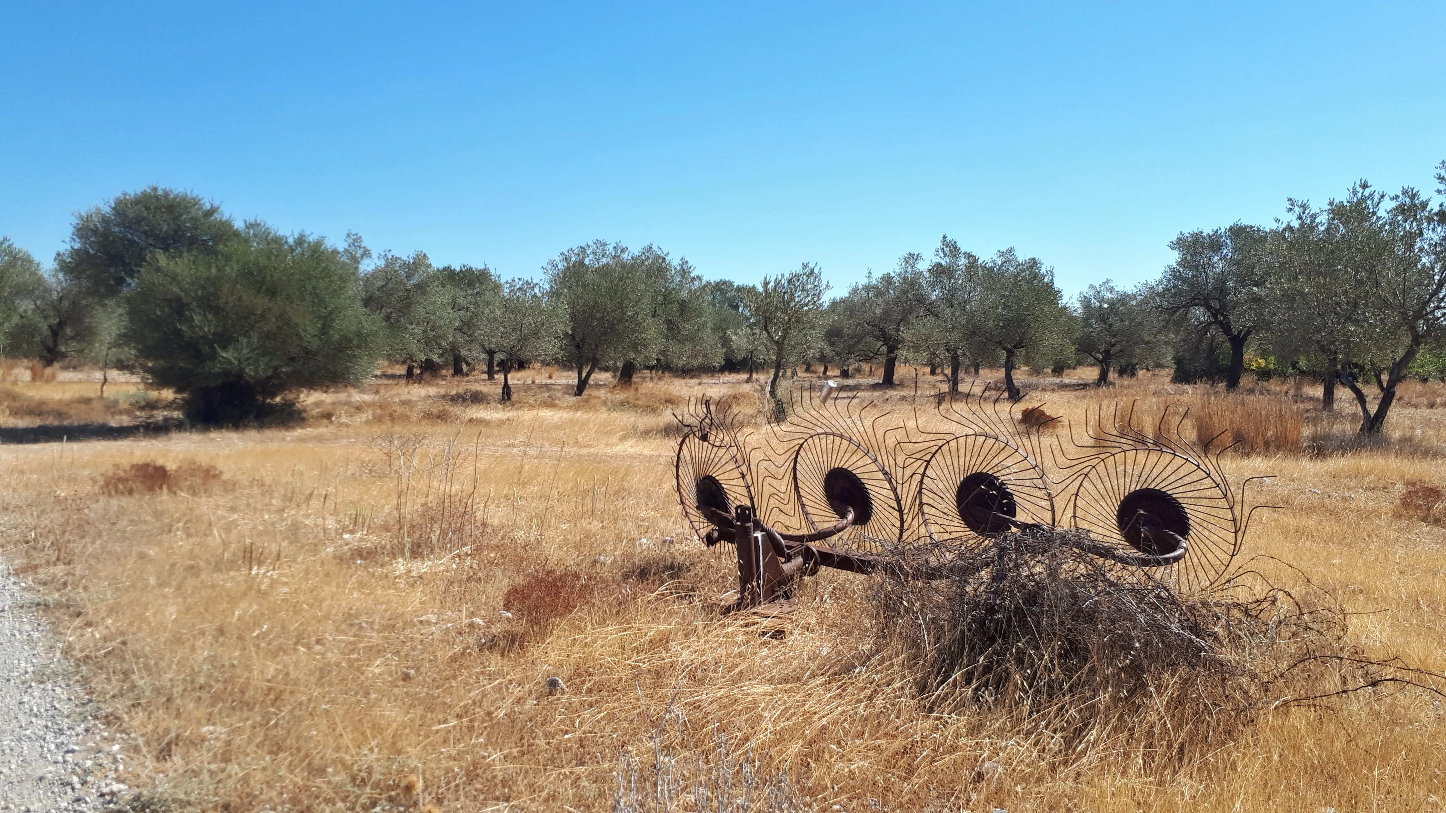
We finally come to the walk back into Masari village, taking a route through the smallholdings
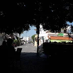
We end the walk under the shaded confines of the tables outside the Rendez-vous taverna with a simple snack complimented by a bottle of Retsina. In conclusion this walk was delightful and highly recommended. It is difficult to choose a favourite walk on the island as each one has its own merits, but for a simple yet adventurous walk this certainly fits the bill.
The melon that had been given to us at the start of the walk was eaten for breakfast one morning and it has to be said that I have never tasted such a delicious sweet fruit as this.
Directions
Walk following the river valleys to the north and west of Masari
Leave Masari village heading north towards Malona. Continue along the road to the river bridge and take the road on the left immediately after the bridge. Keep to this road which follows the course of the river. When the road bears to the right continue straight ahead on the track which leads down into the river gorge. The route is well defined and follows the dry river bed. Keep to this until it crosses over to the right hand bank and cuts across a bend in the river. where it then meets the river on the other side, cross directly over to the opposite bank and continue straight ahead. A ramshackle shelter can be seen ahead and one needs to veer off to the left at this point following the track around to a chapel to the left side of the track. Pass by the chapel and continue on the track ignoring all other tracks. After some 250m past the chapel the track branches. to the left fork. Keep to the main track and ignore all other tracks.
The track emerges at a river bed across which is the road leading to the Kamiri monastery. Cross the rover and turn left onto the road. Continue down the road, across a river bed, and keep to the road on the other side until it meets a junction. Take the left and cross the bridge.
250m after the bridge is a dirt track on the left, take this and walk for a further 1km. A track branches off to the right, take this which emerges onto the main road through Masari village.
Refreshments
Rendez-vous Bar, Masari View in Google Map
- Address
- The Square, Masari
Taverna in the centre of Masari with street seating under broad trees that form a welcome respite from the heat of the day. A grat place to sit and watch the world go by.
Lovely place to end a walk. This occasion we had a plate of Greek meze. Awesome
Image Gallery

Route Validation Cards
Validation Date - 2020-10-10
- Time of Walk: 10:30 to 13:30
- Validators: Griffmonster, Kat
- Weather Conditions: Very warm day
- Notes: Initial route undertaken
Summary of Document Changes
Last Updated: 2026-03-30
- 2020-12-08 : Original publication
- 2021-03-17 : Update website improvements and removal of ViewRanger reliance
- 2021-12-01 : Removal of ViewRanger links due to its imminent demise
- 2026-01-12 : Major website update with all walks recast to the new format


0 comments:
Post a Comment