Massari to Lardos through the hills
A 14.5km walk through the hills between Massari and Lardos
This walk goes in search of the Moni Panagia Tryfenniatisa Massaron monastry that is located in the hills between Massari and Lardos. The effort is well rewarded with a wander through a river gorge, the 16th century chapel and spectacular views.

Walk Statistics
- Start location: Masari
- End location: Asklipio Castle
- Distance: km ( miles)
- Total Gain: metre ( ft)
- Total Descent: metre ( ft)
- Min Height: metre ( ft)
- Max Height: metre ( ft)
- Est. Walk Time:
- Walk type: Linear
- Walk Grade: Fairly easy. There is a steep ascent to the monastery but most of the distance is failrly flat
- Terrain: Dirt tracks
- Obstacles: It is advised that a GPS navigation app is used. Although principally the route is straight forward there are a couple of places where the incorrect track could easily be taken

Maps
The following maps and services can assist in navigating this route. There are links to printed maps and links to downloadable GPX route data for importing into navigational software and apps.
- GPX Route File
Accommodation
Pefkos Blue Studios, PefkosapartmentView in Google Map
- Website
- https://www.pefkosbluehotel.com/
- Description
- Pefkos Blue formerly known as Dimitri Studios, offering self catering apartment studios overlooking Pefkos village with splendid views across the bay. This is probably the best place in Pefkos if you want to be away from the village. Above the hubbub it offers unrivalled views and a quiet location.
Transport
Rhodes Public Transport - Bus Service
- Service Details
- Gennadi to Rhodes Town - KTEL Rhodes Public bus service serving the East Coast of Rhodes linking Gennadi, Kiotari, Lardos, Pefkos, Kalathos, Archangelos, Afandou, Faliraki and Rhodes Town
- Timetable
- https://www.ktelrodou.gr/
Walk Notes
There are many parts of the island of Rhodes that the routine visitor is unaware of. It is true that tourist websites and books provide information on the common tourist destinations and even make mention of a few features that are off the beaten track. In the case of this walk, the main intention was to visit the chapel known as Trifeniotisa Monastery, whose full title is Moni Panagia Tryfenniatisa Massaron, a place that is definitely not on any regular tourist itinerary or brochure. The only reason we knew of its existence was from a conversation with a resident of Massari. Sure enough it does show up on Google Maps and some of the printed road maps of the island also mark it, but other than that, it really is off the beaten track.
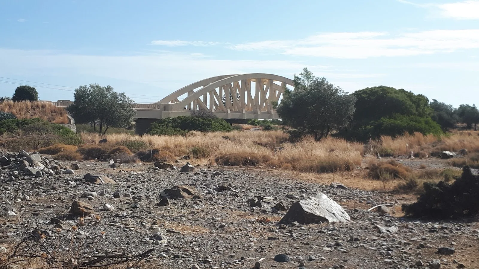
The Monastery sits in the hills behind Kalathos with the principle access via the road across the iconic Italian Bridge
that can be seen in the distance from the main highway between Massari and Kalathos. There is a track just beyond the bridge that follows the river gorge and leads up to the Monastery. After researching maps, there were several possible walks that ranged in distance to provide a route that included a visit to the Monastery. To make things interesting we selected a route that started at Massari and ended at Lardos, negotiating a course through the hills. The principle reason for choosing this option was that it offered several alternatives if paths or tracks were inaccessible and once ascended to 200m into the hills it followed the contours which would make for easier walking considering the heat and the total distance of 14.5 km. Another principle advantage of this route is that there is a bus stop at Massari whereas walking from Kalathos would involve following the main road out of the village, not an ideal walking route by any means.
The bus stop in question is on the main road at the Massari/Haraki crossroads. This is a personal favourite place to alight the bus as there is a little kantina on the junction which makes a great place to have a drink and bite to eat before any adventure begins. It is not a place frequented by tourists which makes it all the more worthwhile, and features in several walks on this site.
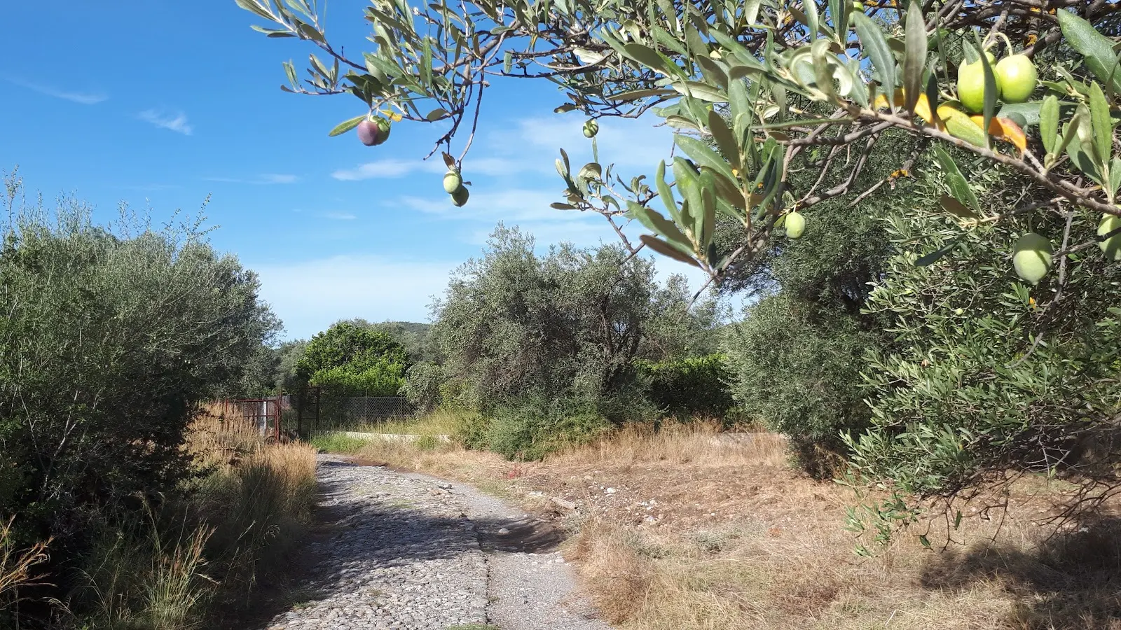
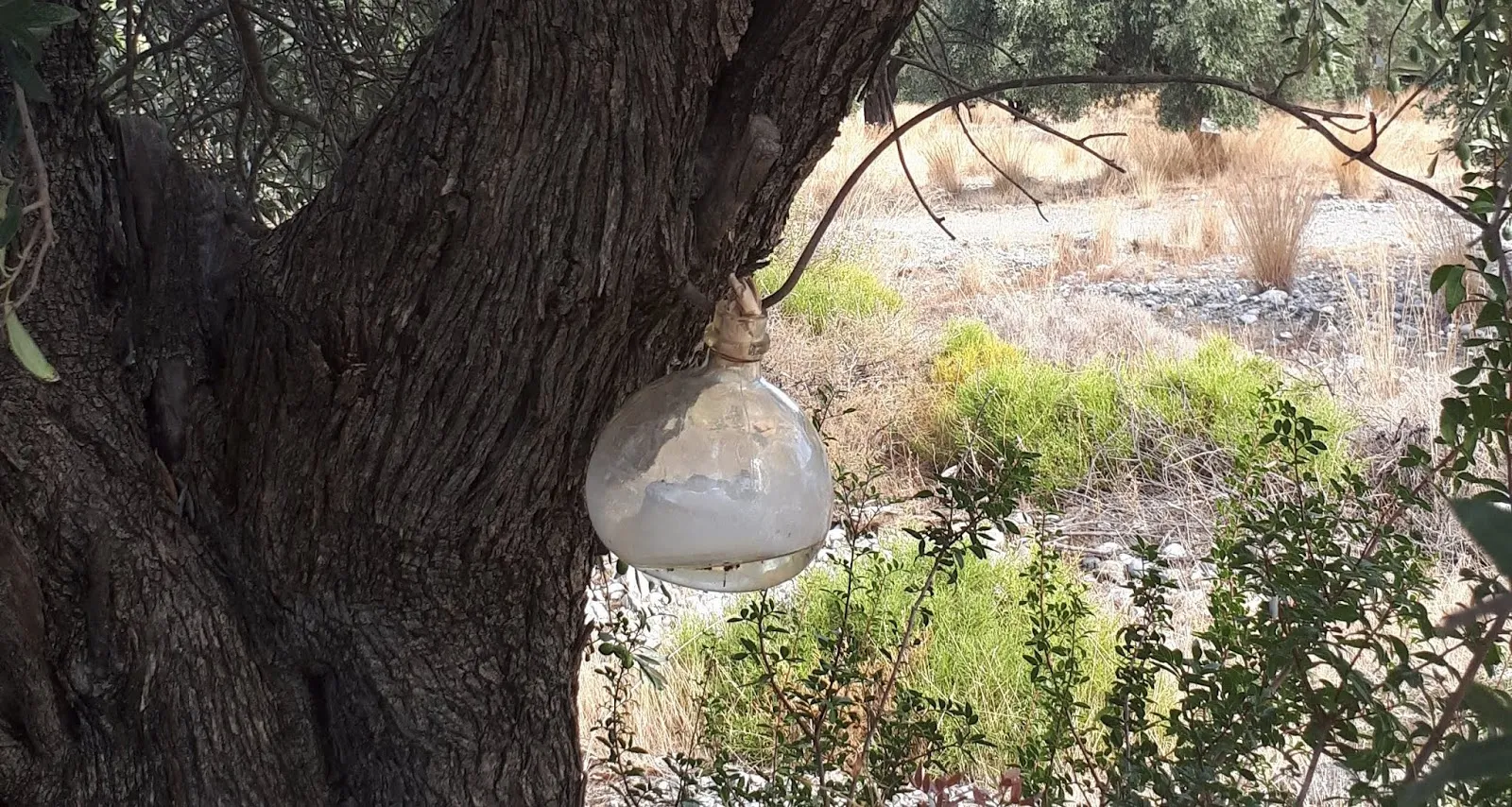
Massari village is just up the road from the junction but before one gets to the village square there is a path off on the left that leads through the lush olive and orange groves. This is a wonderful sight to behold, particularly at the time of year this walk was undertaken, early October, when the fruit is ripening and full. There are some ancient old olive trees along here, great gnarled trunks that are fascinating to ponder over. On this occasion we also observed a glass jar strapped to the trunk of an olive tree. This, as we was informed later at Flyers Taverna in Pefkos, is to collect the resin which is used to make a local liqueur known as mastic. They offered us an after dinner glass of the said drink, which is said to assist digestion as well as prevent colds and freshen ones breath, and has been produced in Greece since the time of Hippocrates, some 2500 years ago. The clear liquid is sweet and has a subtle hint of herbs which does make it an appropriate aperitif to a fine meal.
Later, after researching more about mastic, it would appear that the resin is not from an olive tree but the mastic tree (Pistacia lentiscus), hence the name, although it has to be said that the tree witnessed here was undoubtedly an olive tree. Whether this is something peculiar to Rhodes or whether this was not for drink production is uncertain. It has to be said that we only saw this single tree with the bottle collecting the resin so I don't think this was being performed on anything like an industrial scale and may have merely been for the personal use of the owner of the land, whether that was for creating a drink or for other uses.
At the end of the tracks through the groves one walks out onto an asphalt road. This leads to a junction where the road forks with a small whitewashed chapel sitting in the centre of the fork. Just before this, is a bridge that spans the Skoutoulijaris river, which was no more than a dry river bed during October. A month later, the storms of November 2019 resulted in damage to both the road and bridge from the sheer volume of water that cascaded down this valley ( see photo of the aftermath of the storm). It would appear that the bridge has sustained considerable damage that may make it impassable, certainly to road vehicles and possibly to walkers. No doubt the resourceful local folk will soon instigate a makeshift road across the river bed as always seem to be the case in such situations.
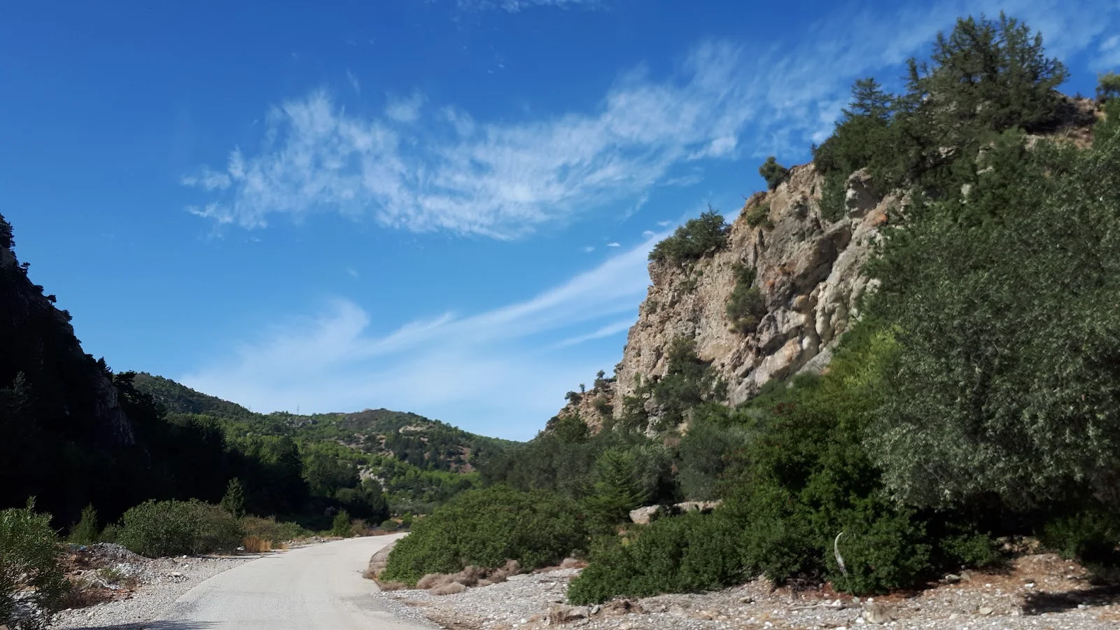
There is now a trek over the long straight road to the Italian Bridge. This broad flat area is where the confluence of several rivers meet, to join and wash out to sea. Most of the year there is no water with the stony bare river beds providing little evidence that waters actually flow. When heavy winter rains come then it becomes more like a vast river delta. The bridge at the end of this road was built during the Italian occupation of the island which lasted from 1912 until 1943, and once carried the national road, now superseded by the modern highway. Therefore these days this road sees little traffic other than the odd local motor or moped. The lifespan of the bridge is testament to its strength during which time numerous other bridges in the area have collapsed or have been swept away by winter storms.
Just before the bridge is a surfaced track that leads up the river valley into the hills. A sign at the junction reads ΙΕΡΑ ΜΟΝΗ ΠΑΝΑΓΙΑΣ ΤΡΥΦΕΝΝΙΑΤΙΣΑΣ ΜΑΣΣΑΡΩΝ
which translates as HOLY MONASTERY OF PANAGIA TRIFFENIATISA MASSARON. Panagia is a title that is used by Eastern Orthodox Christianity to refer to Mary, mother of Jesus. I cannot find any definition or translation to the TRIFFENIATISA MASSARON and assume it is a location.
The river that we now follow is the Gadoura and its course leads to the Gadoura dam which holds back the waters of a large reservoir known as Limni Fragmatos Gadoura. The work on the dam started in 2002 and took 12 years to complete, with the reservoir now supplying mains water to the whole island. We do not get to the dam, merely follow the course through a deep gorge which one cannot fail to be impressed by. Towering hills and cliffs that must have been carved out by thousands of years of cascading waters. Photos do not do this landscape justice. It is totally awe-inspiring and a wonder to behold. It justifies the whole effort of this walk thus far.
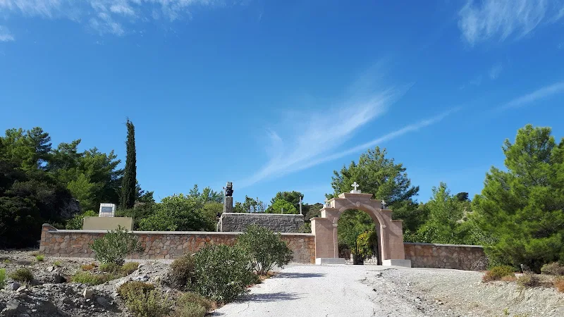
Eventually the track crosses the river bed and starts to climb out of the gorge, with the river course continuing around a bend to head up to the reservoir. In places the inclines are quite steep as the track twists and turns to swiftly rise some 100m. The last part of the climb is fairly straight with a more relaxed gradient that ends in an elegant gated entrance at the centre of the pristine stone wall. This is the perimeter to the monastery.
The use of the word monastery is liberally applied to all and sundry chapels around the island and it does not necessarily relate to a monastery in the definition that is commonly understood in English. It is true that there are some monasteries on the island with resident monks or nuns, but more often than not the term is applied to a Chapel. As far as I can gather, it is generally applied to a compound that consists of more than just a chapel, incorporating courtyards or gardens or walled areas that are used for feasting or other events whereas the term Chapel is applied to the specific religious building at the centre of the monastery or is purely a small church that stands alone without the accompanying features. I could be wrong here as I am only trying find a common distinguishing feature that separates the two terms from the various Greek monasteries and chapels that I have visited thus far, having found no other definition in the documents that I have studied.
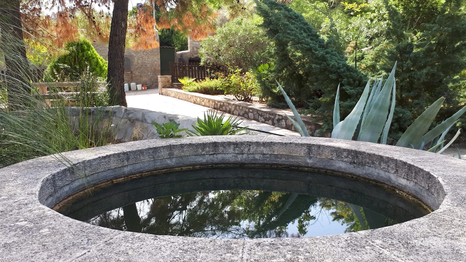
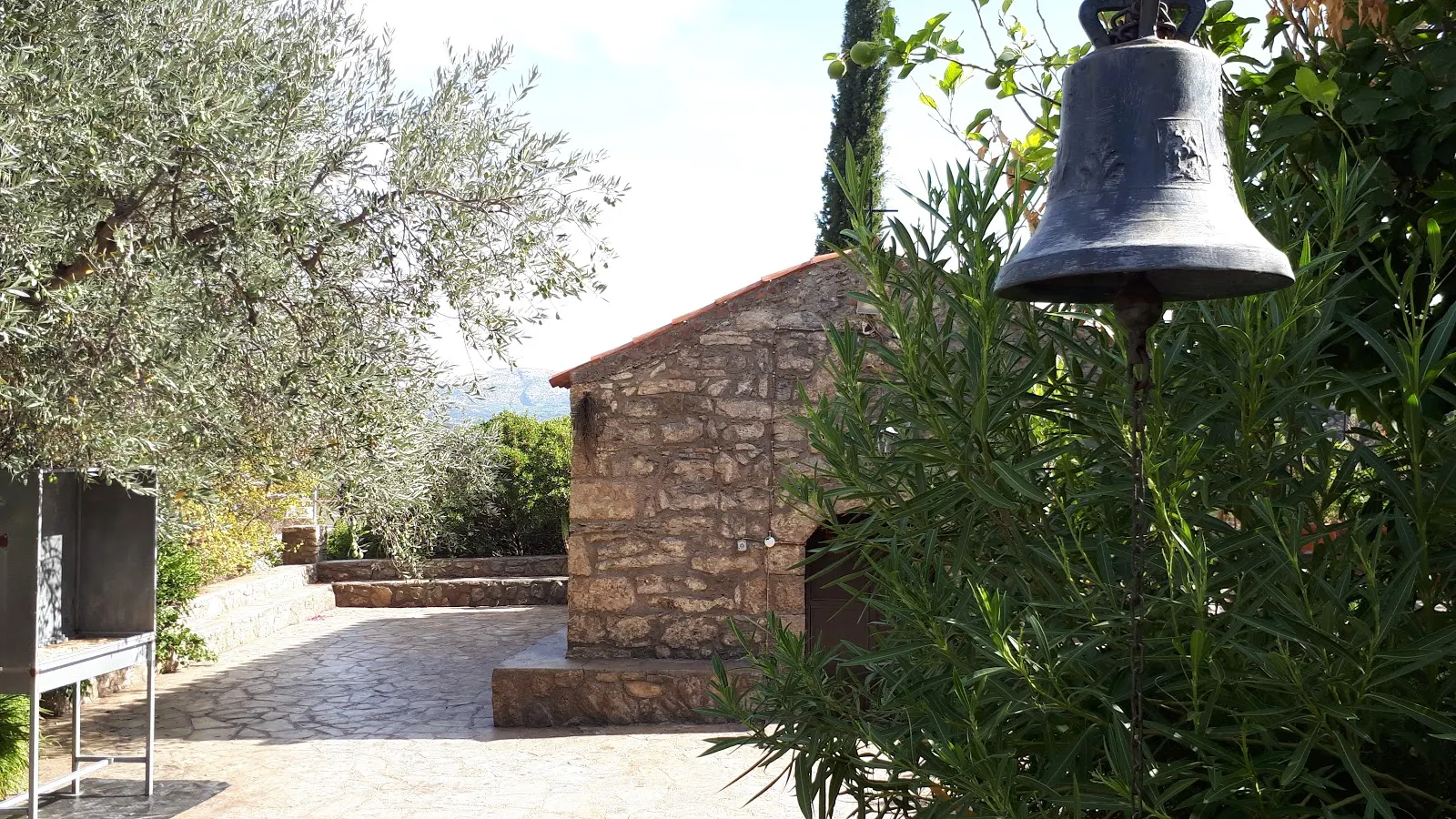
The entrance gates are set within a stone archway that is topped with a four stepped ridge complete with three white crosses. Judging by its clean modern appearance, one may assume that this is a modern construction but do not be deluded by this, enter the compound and you will find that this is all far from modern. The compound consists of a small chapel, a courtyard and a paved garden that has plenty of shade from the lush greenery that is obviously well watered. Benches under the trees provide a welcome retreat to rest, meditate or plainly relax and take this all in. There is an oven built into a wall with a square stone chimney above it, and blackened stones around it are evidence of many years of use. A hosepipe trails around the garden. Numerous large plastic pots appear to assist in the irrigation of these well tended gardens. There are several raised ponds, one with water lilies on the surface. All of this is constructed such that there it is easy to find privacy and seclusion.
At the head of the courtyard, is the humble stone chapel. A bell loosely hangs from wooden scaffold in front of the chapel and it seems only right that one should ring it to announce ones arrival. With a resounding donggggggg the sound absorbs into scenery with no objection from the spirits of the hills. The chapel is unassuming with a simple door painted in a very dark red that has rough handwritten scrawl daubed in yellow paint. The Greek inscription spells out name of the chapel followed by έτος 1600
. Year 1600. This well kept and tidy building is centuries old if this is correct. From the exterior it seems far from it, well maintained stone work that is clean and unweathered. But. Push the door open. Duck to get under the door frame. Then let ones eyes become accustomed to the dark interior. The sight fills ones senses and its age becomes very much apparent. The faded wall paintings give it away, ancient religious murals that have been left unadulterated over the centuries other than by the passing of the years. This really is a treasure to behold. This does make this pilgrimage well worth the effort.
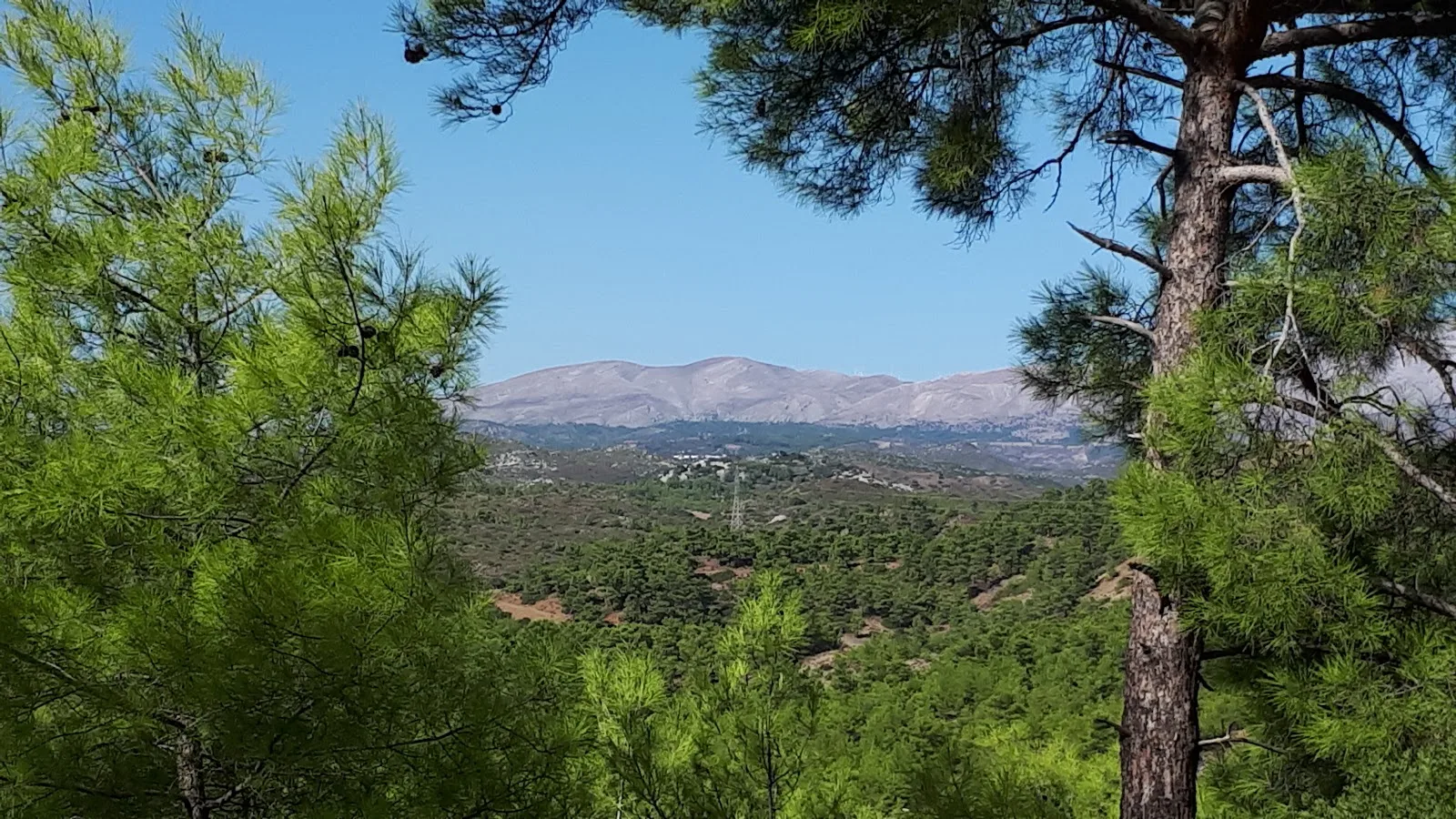
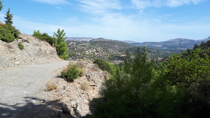
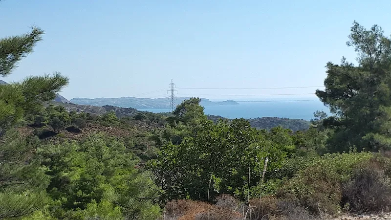
The route now leaves the chapel and the broad track gains height, soon reaching 200m. It is worth stopping and looking back up through the gorge to the Italian bridge, a wondrous scene without a doubt. Cameras click in attempt to distil the essence of the scene into an image but nothing can capture that magnificence. The track now stays at 200m for some easy walking, initially passing through a valley between two summits. It then opens up to reveal the vast open countryside to the west of the island, set within the backdrop of distant mountains. One can only marvel.
There are olive groves up here that are obviously well tended and the track looks particularly well used, rutted with vehicle tracks, yet we see no motors and no people. Peace and quiet with only the hint of a breeze in the trees and an occasional sound of wildlife. There had been some really heavy rains in the days prior to this walk and these had resulted in a few places where the soil across the track had eroded away from streams of water flowing down the hillside. 4WD vehicles may still get past these obstacles but there was one chasm which would require some effort to infill before any motorised charabanc could pass by. On foot it presented no hazard whatsoever to progress onward. For any visitor to the island, it is much better to walk these tracks rather than drive as you see more, you experience more, you feel part of the scenery and at the end of the day you end up with a rewarding feeling. It should also be stated that bringing hire cars up here can result in costly fines for any damage caused to the underside of the vehicle.

It has to be said that this section through the hills is pretty easy walking. It is no more than an amble through the hills with a lot of pine trees offering frequent areas of welcome shade. The miles just melt away and navigation is fairly simple although I would hasten to add that any visitor to these hills should be armed with GPS navigation to prevent getting totally lost.
The track comes to a sharp bend to the left where a makeshift wooden shack sits on the edge of a ledge overlooking the tree filled valley. A white plastic seat vacantly sits by the side of the shack and large plastic barrels and pallets haphazardly litter the side. No-one is around. A little further on are the ruins of what must have been an old stone shepherds hut. It is now no more than stony stumps portraying the perimeter of the structure. The track passes by and then rises to a crest where another track joins from the right. We take this, virtually turning back in the direction we are walking. This is all in the predefined route. This track was not marked on the ViewRanger maps, but Google earth indicated that this path descended down to the Laemra road not far from Lardos. Unfortunately there is no definitive walking map of Rhodes and it is a case of exploring which makes this all the more exciting. If the path was inaccessible, a return to the main track who be required and that would undoubtedly take is through to the Pylona road, a route we had walked the previous year.
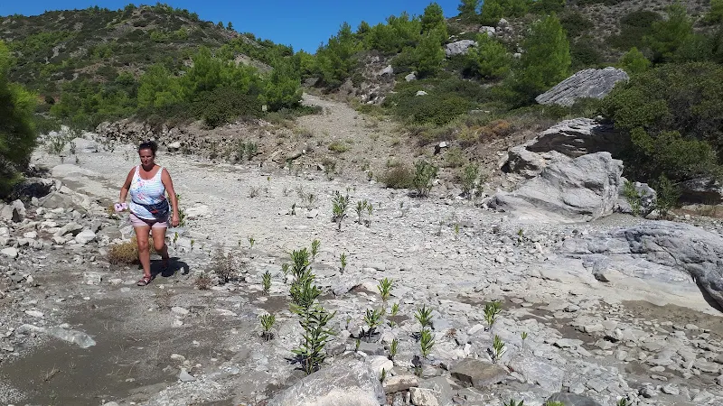
This unmapped track began as a broad well used course that led to a ramshackle compound made up of rough upright sticks and netting which housed nothing more than what looked like pallets. This track was obviously no more than access to this compound, as negotiating the route further the way became narrower and less used although there was the distinct evidence of mopeds having ridden over this ground. By the time the path started to descend it was no more than a wide footpath that led around the hillside, slowly descending down into a valley where a river snaked its way through the scenery. Dry as usual, but its course unmistakable. In places the recent rains had washed the path out and although this never presented a hazard in getting past it did put the thought into ones head that there may be a more serious incursion that would warrant returning back to the main track. In the event, the path remained intact all the way down to the river. It had been a worthy excursion from the main track. At the bottom is a river bed crossing from where the way ahead became another well used track.
A sign stood aside the path as it led up out of the river valley. There had been several signs along the route through the hills, and they had all been in Greek and all appeared to be declaring the direction to the Monastery, its name specifically being noticeable. This notice was different. ΑΓΙΑΓΟΡΕΥΕΤΑΙ ΤΟ ΚΥΝΗΓΙ
it curiously stated. That is AYIAGORIETAI TO KINIYI
in Latinised alphabet. One can do translation fairly easily once one is accustomed to the Greek alphabet and that is not difficult to anyone who has studied mathematics where Greek characters are very familiar. The Latinised words still meant nothing to us unassuming souls. It obviously appeared to be a direction marker. Pointing the route to Kiniyi wherever that may have been. I later looked this up and found it to be nothing of the sort. This is Greek for HUNTING IS BANNED
. Note to oneself - learn more Greek, to prevent searching for the long lost village of Kiniyi!
The last past of the walk rises out of the river valley and bends around the hillsides up to the road. This is easy. The route initially follows the river valley below then turns away to rise up to the road. It is here, the last 100 metres, which is an eyesore. It would appear this is the local dump with a mass of discarded household refuse, building material, unowned cuddly toys, boxes, rubble. Each in a distinct pile, sitting at the edge of the track. Not the best of sights to greet us back to civilisation, but nonetheless a sign that civilisation was upon us.
The road is the direct route in to town. This is a broad modern highway that links Lardos and Laerma but fortunately it is not busy. It makes for an easy hike down into Lardos village. 14.5km completed and well worth the satisfaction of a large glass of beer as a reward for the exploration into the hills.
In conclusion this was a great walk and certainly something I would recommend to any hiker or rambler visiting the island. It is not particularly difficult, but is a fair distance so do take plenty of water. As demonstrated in the write up the landscape is varied, olive groves, flat river valleys, gorges, hills, woodland. It has it all. And it has the magnificent humble monastery.
Directions
Route from Massari through to Lardos through the hills. It is advised to use a GPS phone app or dedicated navigatorwhen walking this route.
The start of the walk is the Massari/Haraki roundabout on National Route 95. Proceed into Massari for 300m where there is a side road on the left, take this and continue onto the track that it leads onto. After another 300m it intersects a road, go straight across and continue on the track beyond. Continue on this track. Ignore all side tracks, keep to the main track. After 1km it junctions with another track, bear to the left onto the main track, not hard left onto the minor tracks. This is a straight track that leads directly to the old National road.
Turn right and follow the road. After 350m the road forks, take the main route bearing left. There follows a 1.5km walk along a straight road across a flat landscape. At the end of this is a sharp bend around to the left that leads across the Italian Bridge. Just before the bridge is a turn to the right that follows the river valley up to a gorge. Take this and keep to the road/track. At 500m the track crosses the river bed to follow the river through the gorge on the opposite side. The track then starts to rise, running around hairpin bends as climbs. Where there is a Y-junction keep to the left and the track rises more until the Monastery comes into sight at the top of another rise.
To the left of the Monastery the track continues. Do not take the track down the side of the monastery. After 1.1km the track junctions with several other tracks. Go straight ahead, but make sure it is on the left hand track that goes straight ahead. Keep to the main track until it turns left with a shack on the right as the track turns, and just after on the left the ruins of a stone shepherds hut. Ahead the track rises, continue for 500m and at the top of the rise there is another track on the right which virtually turns back on the route ahead. Do not confuse this with a similar track just beyond the shepherds hut ruin, the track required is 500m beyond. Take this track, it turns a sharp left and straight ahead is a compound. The track turns left past the compound. The track eventually narrows to no more than a wide footpath that follows the hillside gradually descending. It eventually drops down to the river valley, crosses the river then ascends a short distance to follow the contour of the hills. Keep to this until it meets the road. Turn left and follow the road down into Lardos. At the main junction in Lardos turn right and the village square is a mere 60m ahead.
Refreshments
Memories, Lardos View in Google Map

- Address
- The Square, Lardos
Popular Taverna at the heart of Lardos.
After this four hour hike, what better way than to relax in Memories watching life go by with a long cold beer
Image Gallery
Route Validation Cards
Validation Date - 2019-10-10
- Time of Walk: 09:30 to 13:30
- Validators: Griffmonster, Kat
- Weather Conditions: Very warm day
- Notes: Initial route undertaken
Summary of Document Changes
Last Updated: 2026-03-30
- 2021-03-17 : Update website improvements and removal of ViewRanger reliance
- 2021-12-01 : Removal of ViewRanger links due to its imminent demise
- 2026-01-12 : Major website update with all walks recast to the new format


0 comments:
Post a Comment