Haraki to Kalathos

A 5.5 mile walk along the Rhodes coast from Haraki to Kalathos
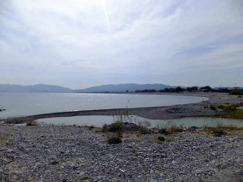
Although short, this is a good afternoons walk along the beach around the bay between the two villages of Haraki and Kalathos. Once out of Haraki the beach becomes deserted of people with the barren land dotted with olive trees on one side and the deep blue sea on the other. The beach is shingle and can become heavy going but for some of the distance there is a dirt track just beyond the beach which makes for easier walking. Take it easy, with stops to dip ones feet in the sea and this makes a relaxing introduction to Rhodes walking.

Walk Statistics
- Start location: Haraki
- End location: Kalathos
- Distance: km ( miles)
- Total Gain: metre ( ft)
- Total Descent: metre ( ft)
- Min Height: metre ( ft)
- Max Height: metre ( ft)
- Est. Walk Time:
- Walk type: Linear
- Walk Grade: Difficult walking across shingle
- Terrain: Shingle beach, tracks and some road walking down to Haraki
- Obstacles: The area is used for military training exercises, make sure none are in operation when undertaking the walk

Maps
The following maps and services can assist in navigating this route. There are links to printed maps and links to downloadable GPX route data for importing into navigational software and apps.
- GPX Route File
Accommodation
Pefkos Blue, PefkosapartmentView in Google Map
- Website
- https://www.pefkosbluehotel.com/
- Description
- Pefkos Blue, formerly Dimitri Studios, Pefkos offers self catering apartment studios overlooking Pefkos town with splendid views across the bay
Transport
Rhodes Public Transport - bus Service
- Service Details
- Pefkos to Rhodes Town - Rhodes Public bus service from Pefkos to Rhodes town. Stops at turns for both Haraki and Kalathos
- Timetable
- https://www.ktelrodou.gr/
Walk Notes
Having walked extensively throughout the UK it is a bit of a shock to the system starting walking in Rhodes. This was the first walk we had performed on the island and certainly highlights a few things that potential walkers would be wise to heed. First of all there is no equivalent of an OS map and the published maps of the island are predominantly orientated towards the driver. As such it was unclear as to our exact position along the beach against the featureless and barren landscape. In hindsight, it would be beneficial to use a GPS tracker app with the GPX file available on this page. Please read the Maps and Navigation page on this site for more details.
Heat is another aspect a newcomer to Rhodes needs to be aware of. In the UK I have walked in the hottest of summers without any difficulty and was a good judge as to how far I could go without any water supplies. This judgement can certainly not be applied to walking in Rhodes, where no matter how little distance one intends to walk, water is absolutely essential. At a distance of 3 miles, such a beach walk in UK terms should take no more than a little over an hour. In Rhodes this distance takes longer and even though the reported temperatures in September was the mid 20's, the land appears to hold the heat from the Summer making it feel a whole lot warmer together with the strength of the direct sunlight which is certainly more powerful than the UK sun. Therefore it was most certainly a mistake to conclude that this short distance could be undertaken without any supplies of fluid and resulted in several dips in the sea to keep cool plus a dousing of water with some discarded water bottles in the welcome shade of a concrete shelter on the edge of the airfield. In all of the walking I have ever undertaken, I don't mind saying that it was scary when dehydration and heat exhaustion starts to set in. We spent a good half an hour in the shelter allowing the body to cool down and acclimatise before continuing. Lesson definitely learnt. No matter how small the distance water is absolutely essential. Please heed this warning.
Whilst resting in that little shelter our attention was soon drawn to a sign that clearly stated no photography
in pictorial signs. This was facing against our direction of travel and no other sign had been encountered from the Haraki side. The fact was we had already taken numerous shots throughout the walk within the area that appeared to be deemed sensitive. No-one stopped us, no-one confronted us. Indeed we encountered no other person and the only evidence that there was any civilisation around was a large ship in the bay anchored close to shore that was seemingly either filling or being filled from a storage tank close to the beach.
Subsequent visits to the area have revealed the Army using the end of the runway by the shelter for firing practice which can clearly be heard many miles away. Hindsight is a wonderful thing and this information should be heeded by other walkers - the GPS and map routes have been adjusted accordingly. As a matter of principle one should avoid this immediate area and continue along the beach to the next road into the village. It should be stressed that you should not take photos of any military establishments or personnel or you may land yourself in deep trouble.
This was a baptism into Rhodes walking and in reality the walk was somewhat cut short due to a lack of map details to determine the exact location along the beach and also somewhat suffering from heat exhaustion. It was the intention to reach Kalathos, but the we misjudged the track from the poor schematic on the map and ended up somewhat short of the village. It is thought that one can continue along the beach through to the Lindos Village resort and then take the road up to the main road which emerges on the southern side of Kalathos. Such a walk may be undertaken in the future, in which case it will be reported on this site.
It should be note that the landward area throughout this walk is the former Gadurrà Airport, named after the river that flows across the area. It is more commonly known as the Italian airfield, and was constructed in the 1930s during the Italian occupation of the Dodecanese. Today it is in a state of deterioration although the main runway is still distinctly visible from both the main road and the beach. The area is used by the Greek military for training exercises and during these times access to the area is forbidden.
Directions
This is predominantly a beach walk. It is advised that you use a GPS tracker with the route that is available on for download on this page
The public bus from Pefkos to Rhodes stops at the junction down into Haraki. From here walk down the Haraki road for about a mile to the village and head around the south side to the beach. Follow the beach around the bay southwards to Kalathos. There are tracks alongside the beach for part of the distance which is easier walking than the shingle. Before reaching Kalathos beach there is a car park with a track leading inland. Take this track and follow it around to the left ignoring all other tracks branching off on the right. This eventually comes to a crossroads with Konstantin Restaurant on the right. Take the right turn and this leads back to the main road. The bus stop can be found a hundred yards left down the road.
Refreshments
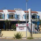
Tommy's Taverna, Haraki View in Google Map
- Address
- Tommy's Taverna, Haraki
- Website
- https://www.facebook.com/Chef.Tommy.Haraki.Rhodes/
Small Taverna on the southern edge of Haraki offering traditional Greek cuisine and drinks.
The taverna was somewhat empty so the service was immediate. Cheese balls, Greek salad and bread together with Alpha beer which was all very good.
Konstantin Restaurant, Kalathos View in Google Map
- Address
- Konstantin Restaurant, Kalathos
- Website
- https://www.konstantinkalathos.com/
Built in 1999 and situated in a landscaped garden with a view of Kalathos village, this modern restaurant has a wine cellar with more than 50 red wines, 35 white wines from the Greek wine-growing regions as well as many European and new world wines. Traditional Greek cuisine including fresh local fish and seafood.
We only had bottles of ice cold water here. Friendly modern taverna.
Features
HarakiView in Google Map
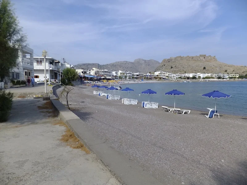
Haraki, aka Charaki (Greek: Χαράκι) is a small fishing village on the east coast of the island of Rhodes that is also a popular small holiday resort, with the usual tavernas, restaurants and bars. Overlooking Haraki is an acropolis known as Feraclos Castle (aka Feraklos) (Greek Φεράκλος) - Feraclos was built by the Knights of St John, and was the last stronghold in Rhodes to succumb to the Ottoman Empire. From the Feraclos castle you can have a panoramic view of Haraki, the sandy beach of Agia Agathi,and more far to the south the town of Lindos.
References
Image Gallery


Route Validation Cards
Validation Date - 2011-09-15
- Time of Walk: 13:30 to 16:30
- Validators: Griffmonster, Kat
- Weather Conditions: Hot sunny day with clear blue skies
- Notes: Initial route undertaken
Summary of Document Changes
Last Updated: 2026-03-30
- 2013-01-14 : Initial Publication
- 2020-10-20 : Adjust maps and add information about avoiding the military area
- 2021-03-17 : Update website improvements and removal of ViewRanger reliance
- 2021-12-01 : Removal of ViewRanger links due to its imminent demise
- 2026-01-12 : Major website update with all walks recast to the new format


5 comments:
Quite excited about this new blog of yours, Griff. I'll place another link on my "links" page!
Thanks John - I will get the other Rhodes walks on here. Takes a little time for me to catch up :)
Griff. Lucky you didnt get shot on this walk
The no photography signs like all over the island indicate army pressence
That area is used for shooting practice
oh my goodness, thanks Trevor, good job it was during the siesta time
"Takes a little time" eh? Griff? Incidentally, Trevor (comment below) has a penchant for the dramatic. I've never heard of anyone getting shot either on that walk or anywhere else. Except that is for the wild game shooters in the hills who occasionally bag eachother!!
Post a Comment